Download
1 / 21
210 likes | 344 Views
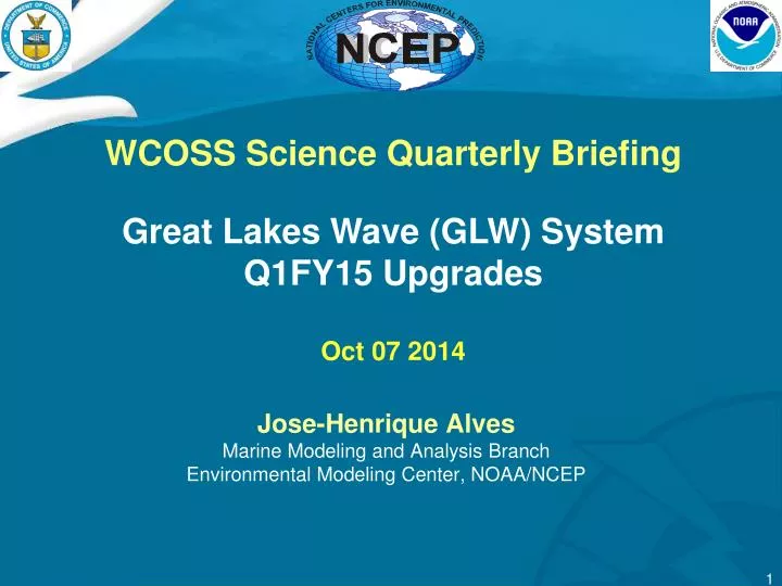
Jose-Henrique Alves Marine Modeling and Analysis Branch Environmental Modeling Center, NOAA/NCEP. WCOSS Science Quarterly Briefing Great Lakes Wave (GLW) System Q1FY15 Upgrades Oct 07 2014. Presentation Outline. Overview System overview Scope of changes Motivation Science testing

E N D
Jose-Henrique AlvesMarine Modeling and Analysis BranchEnvironmental Modeling Center, NOAA/NCEP WCOSS Science Quarterly Briefing Great Lakes Wave (GLW) System Q1FY15 Upgrades Oct 07 2014
Presentation Outline • Overview • System overview • Scope of changes • Motivation • Science testing • Parallel evaluation 2
System Overview • System description • One system, two configs • GLW/NAM (“early”) + GLWN/NDFD (“late”) • 4 + 4 Cycles/day (early, glw; late; glwn) • Grid (lon x lat): 0.05 x 0.035 (~ 4km), 327 x 235 • Single domain covering all major lakes (Superior, Michigan, Huron, Erie, St. Clair) • Upstream dependency: NAM and NDFD model surface winds, air-sea temperatures and ice. • Primary customer base: Great Lakes WFOs, Buffalo, NY Cleveland, OH Chicago, IL Detroit, MI Duluth, MN Gaylord, MI Green Bay, WI Grand Rapids, MI Marquette, MI Milwaukee, WI Northern Indiana.
Overview of Previous Changes • Previous changes in Q1FY14 • A new physics package for wave growth under wind seas • A new physics package for wave dissipation due to wave breaking. • New physics significantly improved model skill for wave height, especially in regions of strong storm wind forcing. • Outcomes • Correction boosted usage of the system by Great Lakes WFOs, some of which are now using solely WW3 (no longer GLERL model) in their wave guidance.
GLW Upgrades for Q1FY15 • Spatial resolution increase from ~4km to ~2km • Old Grid (lon x lat): 0.05 x 0.035 (~ 4km), 327 x 235 • New Lambert Conformal Grid: 2.5km, 688 x 468 • Still single domain covering all major lakes • Matches point-by-point NDFD and NAM-smartinit grids at the lakes • Requirement from WFOs: higher resolution near coastal regions • Intake of new wind data from NAM • Currently GLW uses 12km NAM data up to 84h • Change to a combination of NAM smartinit at 2.5km and 5km to 84h • Intake of new ice concetrations • Currently uses NAM ice mask (no actual concentrations) • Change to conditional climatology over IMS mask
GLW Upgrades for Q1FY15 • Spatial resolution increase from ~4km to ~2km • Old Grid (lon x lat): 0.05 x 0.035 (~4km), 327 x 235 (15527 wet points) • New Lambert Conformal Grid: 2.5km, 581 x 361 (44552 wet points) • Still single domain covering all major lakes • Matches point-by-point NDFD and NAM-smartinit grids at the lakes • Requirement from WFOs: higher resolution near coastal regions
GLW Upgrades for Q1FY15 • Spatial resolution increase (Lake Erie)
GLW Upgrades for Q1FY15 • Spatial resolution increase (Lake Michigan)
GLW Upgrades for Q1FY15 • Spatial resolution increase (Lake Superior)
GLW Upgrades for Q1FY15 • Spatial resolution increase (Lake Huron)
GLW Upgrades for Q1FY15 • Spatial resolution increase (Lake Ontario)
GLW Upgrades for Q1FY15 • Effect of higher resolution grid • Strong westerliesthis week
GLW Upgrades for Q1FY15 • Intake of new wind data from NAM • Currently GLW uses 12km NAM data up to 84h • Change to a combination of NAM smartinit at 2.5km and 5km to 84h • 2.5km NAM smartinit (from 4km NAM) hourly up tp 36h • 2.5km NAM smartinit (from 4km NAM) 3-hourly up tp60h • 5km NAM smartinit (from 4km NAM) 3-hourly up tp84h
GLW Upgrades for Q1FY15 • Intake of new wind data from NAM • CONUS nest (5km) lower bias relative to 12km NAM • SMARTINIT downscaling lower biases relative to 5km NAM • Future SMARTINIT would include 1km terrain adjustment (land-lake transition better represented?) Slide borrowed from Jeff McQueen SMARTINIT update talk on May 08, 2014
GLW Upgrades for Q1FY15 • Effect of higher resolution grid • Strong westerliesthis week
GLW Upgrades for Q1FY15 • Intake of new ice concetrations • Currently uses NAM ice mask (no actual concentrations) • Change to conditional climatology over IMS mask
GLW Upgrades for Q1FY15 • Intake of new ice concetrations • NAM ice mask (from NIC) is extremely conservative • Large areas where there should be waves are masked out
GLW Upgrades for Q1FY15 • Intake of new ice concetrations • NAM ice mask (from NIC) is extremely conservative • Large areas where there should be waves are masked out • Solution: • NIC ice concentrations (NCO in the pipeline) • Bob Grumbine’s conditional climatology (alternative if NCO cannot implement on time for upgrade)
GLW Upgrades for Q1FY15 • Summary of scope • Spatial resolution increase from ~4km to ~2km • Grid (lon x lat): 0.025 x 0.0175 (~ 2km), 688 x 468 • Single domain covering all major lakes • Intake of new wind data from NAM • Use a combination of NAM SMARTINIT • 0-36h 1hrly 2.5km (from 4km NAM) • 39-60h 3hrly 2.5km (from 4km NAM) • 63-84h 3hrly 5km (from 12km NAM) • Intake of new ice concetrations • Use either NIC ice concnetrations (depends on NCO making available this year) or Bob Grumbine’s climatology
GLW Upgrades for Q1FY15 • Concluded schedule • Base code fully implemented at EMC • EMC parallel running with increased spatial resolution • Implement NAM SMARTINIT data intake • Initial code for ice concentrations using NIC data • In progress • Regression testing • Remaining schedule • Finalize coding for new ice concentrations • Start R2O transition • All NCO steps towards implementation
GLW Upgrades for Q1FY15 • Organizational scope (NCEP) • NCO branches • EMC Marine Modeling & Analysis Branch • EMC Developer • Henrique.Alves@noaa.gov • EMC POC • Henrique.Alves@noaa.gov • Arun.Chawla@noaa.gov • External collaborators • GLERL, Great Lakes WFOs and MDL