Download

1 / 15
150 likes | 279 Views
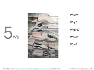
Presented by Suji Gunaratne PhD. WHERE. W ireless H ybrid E nhanced Mobile R adio E stimators. WHERE - Outline. Motivation - Why do we need WHERE ? Partners and their Role in WHERE Objectives of WHERE and WPs WHERE IT Contributions. Why do we need WHERE ?.

E N D
Presented by Suji GunaratnePhD WHERE Wireless Hybrid Enhanced Mobile Radio Estimators
WHERE - Outline • Motivation - Why do we need WHERE ? • Partners and their Role in WHERE • Objectives of WHERE and WPs • WHERE IT Contributions
Why do we need WHERE ? Challenges for future networks covered by project objectives
Main Objectives • The integration of communications and navigation. • Improvement of future wireless communications systems and integration of heterogeneous RAN infrastructures by location based procedures and protocols. • Estimation of MT position information based on terrestrial RANs to enable such location based RAN functions. • Exploitation of communication links to improve RAN based positioning through MT cooperation. • Provision of accurate MT position information to enable location based and context aware services.
Hybrid/Cooperative Positioning Less equipped mobile Short range communication Mobile with GNSS Good knowledge of position • Surrounding mobiles know and provide their position information (e.g. by broadcasting or by answering a ‘ping’) • A less equipped mobile can receive this information via short range communication such as ZigBee or UWB • The mobile position is the intersection of several circles • Works well in dense populated areas. • Maybe such areas coincide with those, where pure GNSS positioning is difficult to achieve
Project Overview • Topic: Cooperative mobile radio communications and localisation • EU Project Proposal: • Type: STREP • Duration: 30 Months • Volume: 529 PMs, 5.5 M€ (73% funding = 4.04 M€) • Goals: • Optimise ubiquitous and converged network and service infrastructures for communication and media • Adaptive and predictive communications exploiting location positioning information for future systems with multiple capabilities on PHY/MAC layer • Improvement of localisation for indoor and urban canyons
Partnership: 12 (+2) partners, 7 (9) countries • Industrial partners • Mitsubishi Electric ITE (F) • SMEs • ACORDE (E) • SigINT (CY) • Siradel (F) • Universities • AAU (DK) • UniS (GB) • IETR (F) • IT (P) • UPM (E) • R&D Centres • CEA-LETI (F) • DLR (D) • Eurecom (F) • Outside Europe • University of Alberta (CDN) • City University of Hong Kong (CN)
WP1: Scenarios and Framework Definition • Early Milestone: • Scenarios to be investigated in the algorithmic WPs and the demonstration WP – needs to be restricted: • Indoor vs. outdoor (urban canyon), Synchronised vs. non-synchronised, Static vs. Dynamic positioning, SISO vs. MISO vs. MIMO, Single vs. multi-cell, Single vs. cooperative system • Scenarios to synchronise different hardware platforms • Appropriate parameters derived from other IST projects and standardisation processes • Late Milestone: • Parameters may be redefined (e.g. communication systems that do not take positioning into account so far)
WP2: Hybrid and Cooperative Positioning • Hybrid Data Fusion and Tracking • Cooperative Positioning WP3: Navigation-aided Cellular Communications • PHY Layer enhancements using localisation data • Location based cross-layer optimisation for PHY/MAC • Enhanced relaying and cooperative communication using positioning data • RAT selection policies and optimisation
WP4: Channel Characteristion • Channel measurements • Creating a fingerprinting data base • Mobility model based on the channel measurements • Investigation of location-dependent channel parameters • Fingerprint-based localization WP5: Demonstration • Exploiting former platforms – get some enhancements to work with higher accuracy for localisation • 3GPP LTE devices • UWB devices • Zigbee devices • Wi-Fi devices
WHERE IT Contributions I • Location assisted RAT selection for B3G Network optimisation • In this scenario it is assumed that the test mobile terminal is a multimode one and that the location of the mobile in both networks are available.
WHERE IT Contributions II • The fact that the mobile can reach more than one network can be exploited towards providing more than one alternatives to questions like: • Detection: What RATs are currently available? • Selection: What RAT to choose; which is “best”?, one or multiple RATs in parallel? Criteria for RAT selection includes QoS, resource usage in terms of codes, power, channel conditions, etc...) • Reselection: Under what conditions reselection is necessary; which network to choose? How reselection is accomplished. Can we anticipate a reselection procedure?
WHERE IT Contributions III • Task 2.2 Cooperative Positioning • Cooperative Positioning • To investigate algorithms/protocols for distributed processing to allow: • Node discovery; how do we identify suitable cooperative nodes. • Node selection. How to identify the “best nodes” to participate in cooperative dialogue; • technique required for selecting the most useful nodes that would provide the most accurate positional estimation • how to fuse the data between the selected cooperating nodes to enhance the positional estimation. • Node reselection. How to we use positional information to reselect new nodes in case of link failure.
WHERE IT Contributions IV • Task 3.2: Location based cross-layer optimization for PHY/MAC • To investigate cross-layer optimization strategies for radio resource management protocols and algorithms that exploit positioning data, based on the underlying PHY layer enhancements from Task 3.1 • Management Responsibilities • WP3 Leader :Navigation-aided cellular communication systems • Task 3.2 Leader: Location based cross-layer optimization for PHY/MAC
Wireless Hybrid Enhanced Mobile Radio Estimators Project Coordinator: Ronald Raulefs Institute of Communications and Navigation German Aerospace Center (DLR) Oberpfaffenhofen, Germany Email: {Armin.Dammann, Ronald.Raulefs}@DLR.de IT Coordinator: Jonathan Rodriguez Email: jonathan@av.it.pt Thank you