Download
1 / 31
310 likes | 520 Views
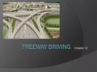
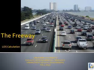
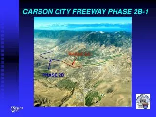
Paul M. Frost, P.E. Principal Hydraulic Engineer Nevada Department of Transportation Mark E. Forest, P.E. Executive Vice-President WRC Nevada, Inc. Mahmood Azad, P.E. Development Services Manager Carson City. Carson City Freeway. Carson Freeway Phase I - Red

E N D
Paul M. Frost, P.E. Principal Hydraulic Engineer Nevada Department of Transportation Mark E. Forest, P.E. Executive Vice-President WRC Nevada, Inc. Mahmood Azad, P.E. Development Services Manager Carson City Carson City Freeway
Carson Freeway Phase I - Red Phase II - Blue Hwy 50 Hwy 50
Project History • Corridor Selection Study (1970’s) • Carson City Endorses alignment in 1984 (“Edmonds” alignment, though center of valley) • Right-of-Way acquisition begins in 1986
Alignment Challenges • Clean Water Act of 1980 (Section 404 - Wetland Issues) • “Species of Concern” - The Carson Wandering Skipper Butterfly • Water Quality Issues (NDEP)
“Thank you for visiting Carson City” Nevada Appeal, 1999
Alignment Challenges (cont.) Floodplain Impacts Alignment is at low point in Eagle Valley (45 sq. mi. watershed, 100-Year = 10,000 cfs FEMA Floodplains / Floodways Published in 1986 18,000 feet of alignment is in within regulatory floodplain 8,000 feet of alignment is in floodway
Floodway 100-Year Floodplain Zone B (Shallow) Carson Freeway
Floodway Zone B (Shallow) Carson Freeway 100-Year Floodplain
Freeway Design Effort • NDOT Begins Design in 1994 • Recognized the necessity for complimentary City and State designs • Carson City and NDOT begin cooperative effort for Freeway and City Master Plan Drainage Design
Freeway Design Effort (cont.) • NDOT / City / WRC Studies • Hydrologic Analysis of Eagle Valley • Galena Creek Watershed Comparison Study • Hydraulic Alternative Development Report • Included Offsite Detention Alternatives (but only on Public Lands) • 404(b)(1) Alternatives Report (minimize environmental impacts) • Lompa Lane Groundwater Analysis
Detention Basin at Gravel Pit Single-Cell RCB Multi-Cell RCB Collector Channel Multi-Cell RCB Water Quality Basin Collector Channel Open Channel
New Years Day Flood, 1997a.k.a. “Then It Rained” • Significant event in Eagle Valley • Over a 100-Year event on Vicee Canyon • Major sediment loads
1997 Flood, continued • Could have been worse • Existing gravel pit on Vicee acted as retention basin • Roughly __ feet of sediment deposition
Inter-Local Agreement • 1997 event stressed the need for major, comprehensive flood control infrastructure • Through a Partnering Process, Carson City and NDOT cooperate to develop a regional flood control solution
Carson City Stormwater Master Plan • 1994 Master Plan • 401b Alternatives Analysis • Northwest Alternatives Analysis
Northwest Alternatives Study • Watershed Area for Phase 1B • Existing Detention • Within Silver Oaks Development (Evaluation) • Detention and Conveyance Alternatives
Northwest Alternatives Study • Goals and Purpose: • Regional Flood Control Planning • Integration of Regional Flood Control with Freeway Project • Reduction in Costs for Freeway • Reduction In Costs for Carson City • Reduction in Environmental Impacts • Significant Reduction in Floodplain Area
Northwest Alternatives Study • State/Local/Private Partnership • Nevada Department of Transportation • Carson City • Developers • Advantages • Land Acquisition • Shared Costs • Regional Flood Control Measures Expedited
Project Features • Detention Basins • Shenandoah Heights (Carson City) • Eagle Canyon • Silver Oaks (3 Basins with Golf Course) • Conveyance Facilities • Channels • Culverts • Storm Drains
Project Benefits • Reduction in Floodplain/Floodways • Reduction in Facilities Costs • Reduction in Utility Relocation Cost • Reduced Flood Risk to Public Facilities • Reduced Maintenance Costs
Conclusions • State/Local Partnerships Have Benefits • WIN - WIN For Everyone • Advanced Planning Is Valuable • Everyone Saves $$$ • Maintenance is Reduced • Results in Significant Public Benefits