Download
1 / 16
200 likes | 414 Views
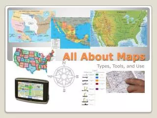
All About Maps. Maps are drawings that show where things are located. People have been making maps for thousands of years. The oldest known map was scratched onto a flat piece of clay called a tablet . It was made by a group of people called the Babylonians. It showed

E N D
All About Maps Maps are drawings that show where things are located. People have been making maps for thousands of years. The oldest known map was scratched onto a flat piece of clay called a tablet. It was made by a group of people called the Babylonians. It showed the world as they knew it.
Cartographers A cartographer is an artist or scientist who makes maps. One famous cartographer was named Claudius Ptolemy. He created maps where north is at the top of the page and east is to the right. He also made a key or legend with symbols. Cartographers still use and do these things today.
Christopher Columbus Maps Change Over time maps have changed. The more people explored the land and seas the better maps became. In 1492, Christopher Columbus traveled from Spain to the Americas and charted or mapped new lands. This map was made before Christopher Columbus traveled to the Americas. This map was made after Christopher Columbus traveled to the Americas.
Maps Today With the help of satellites and computers we have maps that are more detailed and are more accurate today.
Map Parts Maps have many parts that help people read and understand them. A compass or compass rose shows direction. Symbolsare simple drawings that represent something else.
A scale shows the distance between two places . 1 mile 2 miles 3 miles 4 miles 5 miles Scale : 1 inch = I mile Borders are the lines that separate two places on a map. The lines inside the United States show how the land is separated into different states. Keys or Legends are a list of symbols and their meanings. = forest bridge airport Capitol city ✪
A grid is a set of connected squares. A letter and number are given to each square. C A B Can you figure out the location or coordinates for the different butterflies 1 2 Example: The pink butterfly is in the square with the coordinates A3. 3
Maps can show us… countries, cities, and oceans.
Maps can show us… landforms like rivers, lakes, mountains, and valleys.
Maps can show us… weather.
Maps can show us… trails or paths.
Maps can show us… streets, roads, or neighborhoods.
Maps can show us… schools. http://commons.wikimedia.org/wiki/File:Gilman-school-map-06-24-09.jpg
Maps can show us… towns.
Clip art by http://www.teacherspayteachers.com/Product/Geography-Clip-Art-539943