Download
1 / 24
250 likes | 387 Views
Subsurface Analyst, Modflow Data Model, MODFLOW Analyst. Acknowledgments (Aquaveo team): Doug Gallup Michael Kennard Alan Lemon. Norm Jones (Brigham Young University) Gil Strassberg (Aquaveo). Outline. Subsurface Analyst – Tools for subsurface characterization

E N D
Subsurface Analyst, Modflow Data Model, MODFLOW Analyst Acknowledgments (Aquaveo team): Doug Gallup Michael Kennard Alan Lemon Norm Jones (Brigham Young University) Gil Strassberg (Aquaveo) UC2008 Pre-conference Seminars
Outline • Subsurface Analyst – Tools for subsurface characterization • MOFLOW Data Model - Geodatabase design for storing modflow simulations • MODFLOW Analyst - Tools for Building, importing, and post-processing of MODFLOW models
Subsurface Analyst • Borehole management • Borehole visualization • Cross sections • Volumes
Subsurface Analyst - Demo UC2008 Pre-conference Seminars
Outline • Subsurface Analyst – tools for subsurface characterization • MOFLOW Data Model - Geodatabase design for storing modflow simulations • MODFLOW Analyst - Tools for Building, importing, and post-processing of MODFLOW models
Boundary Polygon J I
Cell2D & Node Feature Classes Mesh-Centered Finite Difference Cell-Centered Finite Difference Finite Element
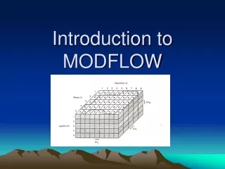
MODFLOW Data Model • Data standard for storing MODFLOW models in a GIS database • Importing models built externally • Archiving calibrated models • Building new MODFLOW models inside ArcGIS • Custom scripts for analyzing/modifying models can be developed as geoprocessing tools
Outline • Subsurface Analyst – Tools for subsurface characterization • MOFLOW Data Model - Geodatabase design for storing modflow simulations • MODFLOW Analyst - Tools for Building, importing, and post-processing of MODFLOW models
MODFLOW Analyst • Import / Export MODFLOW files • Build package data • Run MODFLOW • Display, visualization of model data • Post-processing
Import MODFLOW Model Tool INPUT OUTPUT
MODFLOW Query Tool + Or INPUT OUTPUT
HydraulicConductivity Bottom Elevations Cell2D Features Stresses Active Cells ET Zones Node Features MODFLOW Map Layers
Build Package Input • Discretize: • Spatial • Polygons K zones (overlay) • Points K values (interpolate) • Polylines River cells • Points Wells • Temporal • Time Series Stress Periods
Geoprocessing Tools • GP tools enable the development of workflows as models or scripts • Extendable – You can create your own workflows • Leverage low-level tools to create new tools
Sample Application – Well Permitting Calibrated AHGW MODFLOW model(s) archived on ArcGIS server GP tool locates model, adds well, exports MODFLOW files Well data (coordinates, pumping rate, etc.) are sent to server Applicant uses web form to apply for new well Custom series of GP tools are executed to determine impact of well Results are compiled into a report and e-mailed to review staff MODFLOW solution is computed, imported to database on server
Contact Information Norm Jones 242L Clyde Building Brigham Young University Provo, Utah 84602 njones@byu.edu • More material: • http://support.esri.com/datamodels • http://www.archydrogw.com