Download
1 / 27
330 likes | 574 Views
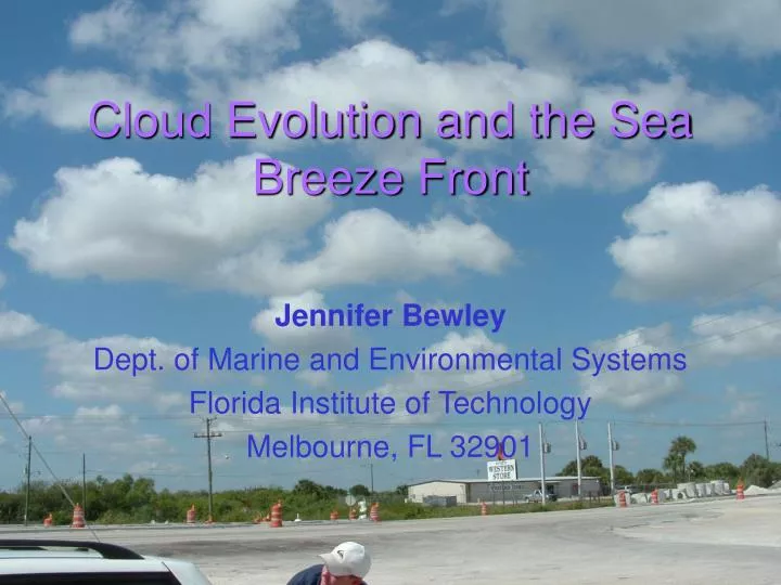
Cloud Evolution and the Sea Breeze Front. Jennifer Bewley Dept. of Marine and Environmental Systems Florida Institute of Technology Melbourne, FL 32901. Overview. What is a sea breeze? What is a sea breeze front? Satellite Cloud Edge Radar Thin Line Why study sea breezes? Objectives

E N D
Cloud Evolution and the Sea Breeze Front Jennifer Bewley Dept. of Marine and Environmental Systems Florida Institute of Technology Melbourne, FL 32901
Overview • What is a sea breeze? • What is a sea breeze front? • Satellite Cloud Edge • Radar Thin Line • Why study sea breezes? • Objectives • Method • Data • Synoptic Setting • Results • Conclusions • Questions
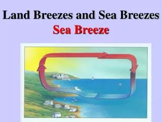
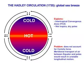
Background Information • What is a sea breeze (SB)? • Differential heating between land and sea • Formation of a thermal low over the land and a thermal high over the water • A pressure gradient forms, air flows from high to low pressure • Creates the sea breeze • Opposite effect happens at night creating the land breeze • What is a sea breeze front (SBF)? • The leading edge of the sea breeze • A drop in temperature, a wind shift, and an increase in relative humidity occurs behind the front
Sea Breeze Circulation Source: <http://www.bom.gov.au/weather/nsw/amfs/Sea%20Breeze.shtml>
Background Info. Continued… • Satellite Cloud Edge • Seen on visible or infrared satellite images • A line of cumulus clouds, parallel to the shore, with no more clouds on the seaward side of the line of development
Background Info. Continued… • Radar Thin Line • A region of enhanced radar reflectivity in the optically clear boundary layer detected by a sensitive Doppler radar • Intense mixing of land and marine air provides several interfaces capable of reflecting radio energy
Why Study Sea Breezes? • Forecasting • Changes temperature, wind speed and direction, and relative humidity • Convection, Clouds, Turbulence • Climate Modeling • Formation of clouds • Renewable Energy • Wind and solar energy • Operationally, how can you accurately locate the SBF?
Objectives • To compare the location of the satellite cloud edge to the surface sea breeze front and the location of the radar thin line • To analyze the differences in the location of the indicated features and create a possible vertical profile of the sea breeze front
Method • Team Beach • Melbourne Beach • Measured air temperature, RH, and wind speed every 15 mins. • Sky observations, water temperature, wave height and period, salinity, and dissolved oxygen were taken every 30 mins. • Team FIT • Collected data
Method Continued… • Team Mobile Unit • Traveled west on 192, attempting to transect the SBF • The mobile unit was equipped with a wind vane, cup anemometer, and radiometer. • Wind speeds, RH, air temperature, sky observations, percent cloud cover and wind direction were recorded.
Data • Team Beach & Team Mobile Unit • Wind speed and direction • Team FIT • GOES 4 km visible satellite imagery • Melbourne NWS Doppler radar base reflectivity images • Other surface observations
Results • Analyzed the progression of the cloud edge, thin line, and the surface fronts • Developed a model to find the relation of the features for each day
Results Continued… May 25* = Strong easterly flow
Conclusions • The thin line precedes the surface front which precedes the cloud edge • The actual distances between these features vary and depend on several factors • Operationally, the satellite cloud edge may not always be a good indication of the location of the surface SBF • One improvement would be to have higher resolution data, especially satellite and radar imagery and more sampling sites
Acknowledgements • A special thanks to… • Mr. Splitt for advising this project and aiding with the creation of figures • Mr. Leslie for the mobile renewable energy station • Andrew Condon for the synoptic maps • All the MFP students and TA’s for helping with the data collection