Download
1 / 41
410 likes | 549 Views
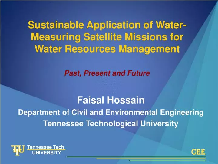
T. U. T. C. E. E. Tennessee Tech. CEE. UNIVERSITY. Sustainable Application of Water-Measuring Satellite Missions for Water Resources Management. Tennessee Technological University. Past, Present and Future. Faisal Hossain. Faisal Hossain

E N D
T U T C E E Tennessee Tech CEE UNIVERSITY Sustainable Application of Water-Measuring Satellite Missions for Water Resources Management Tennessee Technological University Past, Present and Future Faisal Hossain Faisal Hossain Department of Civil and Environmental Engineering Tennessee Technological University
T U T C E E Tennessee Tech CEE UNIVERSITY ACKNOWLEDGEMENTS • Former and Current Students-Amanda Harris, Preethi Raj, Nitin Katiyar, Jon Schwenk, Rahil Chowdhury, Ling Tang and Caitlin Balthrop. • Collaborators– University of Connecticut, University of Mississippi, Ohio State University, NASA Goddard Space Center (Laboratory of Atmospheres and Hydrologic Sciences Branch), McNeese State University, University of Oklahoma, Oregon State University, University of California-Davis, University of Dhaka, Indian Institute of Technology-Kanpur. • Sponsors– NASA Rapid Prototyping Capability Program; NASA Precipitation Measurement Program; NASA Earth System Science Fellowship; TTU Research Initiation Grants, TTU Water Center, Ivanhoe Foundation, Mississippi Department of Environmental Quality. • International Partners– Institute of Water Modeling (Bangladesh), International Precipitation Working Group (WMO), Bureau of Meteorology (Australia). Tennessee Technological University Faisal Hossain
T U T C E E Tennessee Tech CEE UNIVERSITY OUTLINE Tennessee Technological University • Primary Research Area: Scientific evolution of the concept of ‘sustainability’ for water-measuring satellites for water resources management. • Overview of Complementary Research and Education Agendas. Faisal Hossain
T U T C E E Tennessee Tech CEE UNIVERSITY WATER ‘MEASURING’ SATELLITES - 101 Tennessee Technological University • Hydrologic Remote Sensing- Microwave MW (1-20cm) and Infrared IR (< 0.1cm) Wavelengths. • Water Cycle Variables-‘Rainfall’, ‘Soil Moisture’, ‘Discharge’. • Water has a dipole and high dielectric constant. • Orbiting and Geostationary platforms; Passive/Active. • MW sensors mostly orbiting– higher accuracy, lower sampling frequency (space-time). • IR sensors mostly geostationary platforms– lower accuracy, higher sampling frequency (space-time). Faisal Hossain
T U T C E E Tennessee Tech CEE UNIVERSITY WATER MEASURING SATELLITES - 101 TRMM WaTER (SWOT) Tennessee Technological University Faisal Hossain Geostationary Orbit HYDROS
T U T C E E Tennessee Tech CEE UNIVERSITY WHAT IS ‘SUSTAINABILITY’ FOR WATER MEASURING SATELLITES? Tennessee Technological University “Sustainabilityis a characteristic of a process or state that can be maintained at a certain level indefinitely.” -Wikipedia For water measuring satellites?– To make ‘optimal’ use of satellite sensor’s capability to ‘measure’ water looking down over a large area from the vantage of space. Faisal Hossain Optimal Use?– Identify, maintain and enhance the realistic limits to which satellite hydrologic data can be used for analysis, modeling and monitoring of water resources.
T U T C E E Tennessee Tech CEE UNIVERSITY The Conceptual Appeal of Water-Measuring Satellites to the Hydrologist Tennessee Technological University • In-situ networks– globally disappearing or absent; expensive maintenance; limited by point-scale. Faisal Hossain Source: Climate Prediction Center Effective sampling area of the world’s rainfall gages is the size of a few football fields! Source: USGS
The Conceptual Appeal of Water-Measuring Satellites to the Hydrologist T U T C E E Tennessee Tech CEE UNIVERSITY Tennessee Technological University • Global Hydrology (Earth’s Energy/Water Budget)– Can only be supported by space-borne instruments (75% of surface is oceans). • Flood prone Tropics– sparse or non-existent network where floods are most catastrophic. Faisal Hossain
T U T C E E Tennessee Tech UNIVERSITY Transboundary Flood Forecasting: The Story of the Niger River 1. 4030 km long, 211,3200 km2 2. Flows through 5 countries 3. Drainage area comprised of 11 countries 4. Frequent river flooding induced by heavy rainfall Question: How does one monitor early the evolution of river flooding across political boundaries of 5 nations, 11 administrations and a diverse landscape? 5. Diverse climate, rainfall regime, soil conditions, topography = varying response of landscape to rainfall
T U T C E E Tennessee Tech CEE UNIVERSITY Transboundary Flood Forecasting: The Global Picture on International River Basins Tennessee Technological University • Hydro-political limitations worsen at the shorter time scales 145 countries are associated in IRBs Accounts for 40% of total land surface. > 50% of total surface flow Faisal Hossain 214 International River Basins in 1979 UN Register 261 in 2002 (Updated) Source: Dr. Aaron Wolf, Oregon State University
T U T C E E Tennessee Tech CEE UNIVERSITY Appeal in terms of Future Scenario Tennessee Technological University Faisal Hossain WaTER (SWOT) Expected launch– 2016 Q for major rivers every 2-3 days Expected launch 2013 3 hourly global rainfall products at 10X10 km scale
T U T C E E Tennessee Tech CEE UNIVERSITY Appeal in terms of Future Scenario Tennessee Technological University Faisal Hossain Hossain, F., N. Katiyar, A. Wolf, and Y. Hong. (2007). The Emerging role of Satellite Rainfall Data in Improving the Hydro-political Situation of Flood Monitoring in the Under-developed Regions of the World, Natural Hazards, Invited Paper
T U T C E E Tennessee Tech CEE UNIVERSITY Problems with Water Measuring Satellites • OLD Issues (Relatively longer known and accepted) • MW temporal sampling of rainfall was low until late 1990s. IR Rainfall data useful at > degree-monthly scales. • Scale Incongruity (satellite rainfall/moisture data too large for dynamic terrestrial hydrology). • Soil moisture accuracy limited by the need for long MW wavelength (L-band). • Passive MW (PMW) data for discharge estimation has been good only for large, ‘steady’ (glaciers) rivers on monthly timescales. • Historical solutions devised by hydrologists for handling coarse resolution data: Spatial-Temporal downscaling. Tennessee Technological University Spatial Downscaling Faisal Hossain
T U T C E E Tennessee Tech CEE UNIVERSITY Chronology of Scale and Accuracy of Satellite Rainfall Data Tennessee Technological University 1970 – 1980 – 1990 – 2000 - 2010+ • Faisal Hossain • IR Sensors on GEO platforms • Good space-time sampling • IR parameters weakly related to rainfall process • More Merged Products • Tropical Rainfall Measuring Mission- TRMM • Anticipation of GPM • 3 hourly and globally coherent rainfall data • PMW Sensors on LEO platforms • Poor space-time sampling • PMW parameters strongly related to rainfall process • Merging or IR with PMW began 1 Degree-Monthly 0.25 degree – 3 hourly
T U T C E E Tennessee Tech CEE UNIVERSITY Problems with Rainfall Measuring Satellites • NEW Issues on Satellite Rainfall Data (Recent Insights – post 2004 era) • Existing frameworks and metrics (bias/rmse, correlation) inadequate for assessing hydrologic potential of satellite data. • Satellite rainfall error more complex (multi-dimensional) than conventional network data. • Complexity of error increases as scales (time/space) decrease – non-negligible for dynamic hydrologic modeling. Tennessee Technological University Faisal Hossain
T U T C E E Tennessee Tech UNIVERSITY All Overland Satellite Rainfall Algorithms are Probabilistic at Hydrologically Relevant Scales Four Possible Outcomes of a Rainfall Sensor at any given time: 1. Successful Rain Detection/Delineation (HIT) 2. Unsuccessful Rain Detection/Delineation (MISS) 3. Successful No-Rain Detection/Delineation (HIT) 4. Unsuccessful No-Rain Detection/Delineation (MISS) • Rainy/Non-rainyarea delineation has a distinct spatial structure • Systematic errorhas a non-negligible spatio-temporal structure • Random errorhas a spatial structure • Regime Dependenceof error structure on climate, location, season
T U T C E E Tennessee Tech CEE UNIVERSITY Our ‘Sustainable’ Solution and Framework for Old and New Problems Tennessee Technological University HYPOTHESIS: New approaches needed for hydrologists that recognize scale incongruity. “As space and time scales become smaller, the passive sensor’s precipitation measurement characteristics become more complex and random. Fine-scale hydrologic assessment of satellite rainfall retrievals requires the recognition of this increasing complexity of satellite precipitation error structure.” Faisal Hossain Hossain and Lettenmaier, 2006,Water Resources Research
T U T C E E Tennessee Tech UNIVERSITY We Need Hydrologic Process-based Understanding of Scale Incongruity Watershed = Non-linear system yavg≠ f(xavg) Time Space Non-linearity Thresholding An infiltration approach to surface runoff modeling (physically-based) as follows:
T U T C E E Tennessee Tech UNIVERSITY ONE Hydrologically Relevant Frameworks should answer three key questions – Q1. How does the error vary in time? Q2. How does the error vary in space? Q3. How “off” is the rainfall estimate from the true value over rainy areas? TWO Metrics should have ‘Diagnostic’ and ‘Prognostic’ value Diagnostic – Able to quantify uncertainty on a specific feature/dimension of precipitation. Prognostic– Amenable for use in a mathematical error model for synthetic generation of high resolution satellite rainfall data. Our Generalized Framework for the Community (IPWG- PEHRPP) – For Rainfall Hossain, F. and G.J. Huffman. (2008).Investigating Error Metrics for Satellite Rainfall at Hydrologically Relevant Scales, Journal of Hydrometeorology (In press)
Rainfall as an Intermittent Process Rainy Areas Non-Rainy Areas How well does satellite data delineate the rainy/non-rainy areas? MISS ? MISS ? HIT ? HIT ? False Alarm (Probability distribution Parameters) (3) Probability of detection of No- Rain (fixed marginal value) (2) Probability of detection of Rain (As a function of magnitude of reference or satellite rainfall (1) How does the error vary in space? Correlation Length of Successful Detection of Rain (4) Correlation Length of Successful Detection of No-Rain (4) How ‘off’ is rainfall estimate from true value over rainy areas? T U Systematic and Random Errors in Retrieval (6) and (7) T C E E Correlation Length of Retrieval (8) How does the error vary in time? Temporal Correlation of Systematic Error in Retrieval (9) Tennessee Tech CEE UNIVERSITY Two-Dimensional (x-y) Satellite Rainfall Error Model – SREM2D Tennessee Technological University • Based on the concept of ‘reference’ (ground validation) rainfall. • Modular in design (collection of concepts) – for any rainfall product. • Total Error Metrics - 9 • Uses Error Metrics interpretable by both hydrologists and Data-producers. • Currently used by other research groups (MSU; UArizona; OleMiss). Preferred by NASA Laboratory of Atmospheres. Faisal Hossain Hossain and Anagnostou (2006) IEEE Trans Geosci. Remote Sensing, 44(4).
T U T C E E Tennessee Tech CEE UNIVERSITY Transboundary Flood Monitoring: New Questions for Assessing Sustainability Tennessee Technological University General Science Question How realistic is the use of satellite rainfall in overcoming the transboundary limitations to flood monitoring? Specific Questions Whatspecific IRBs, and downstream nations would benefit more than others from GPM? Can we develop rules of thumb for application of satellite rainfall data in ungauged IRBs? Faisal Hossain
T U T C E E Tennessee Tech UNIVERSITY ‘Ball Park’ Assessment for NASA product 3B41RT Improvement Major Minor Negative Fully Distributed Open-Book Hydrologic ModelKANPUR 1.0 by Katiyar, N. and Hossain, F. 2007 Environ. Mod. Software, vol. 22(12).
T U T C E E Tennessee Tech UNIVERSITY Speculations on IRBs where Satellite Rainfall Data will be ‘Sustainable’ for Flood Monitoring Preliminary Speculation - Setting aside ALL assumptions Improvement Negligible Improvement
T U T C E E Tennessee Tech UNIVERSITY More Intelligent Speculation Based on Koppen Climate Classification Source: Encyclopedia Britannica
T U T C E E Tennessee Tech UNIVERSITY Speculation on IRBs (Contd.) Cfa & Cwa– Humid Subtropical; Bsh- Semi-arid GangesRiver– Bangladesh (+45%) ↑Yalu and Tomen Rivers – North Korea (+20%)↑LimpopoRiver – Mozambique (+35%)↑SenegalRiver– Senegal (+42%)↑La Plata River– Uruguay (+45%)↑
T U T C E E Tennessee Tech CEE UNIVERSITY Spatial Downscaling of Satellite Rainfall Data: New Questions for Assessing Sustainability Tennessee Technological University • Spatial downscaling based on scale invariance. • Preserves the mean of rainfall. • Stochastic in nature – yields equi-probable realizations. • Mimics the expected variance of rainfall at downscaled resolution. • Downscaling schemes preserve the mean and mimic the expected variance. Is that good enough for flood prediction needs for GPM? • Satellite rainfall data has scale-dependent complex error– • i) Does the downscaling scheme add artifacts to downscaled satellite rainfall data? • ii) What are the hydrologic implications of using a spatial downscaling scheme for satellite rainfall on flood prediction uncertainty? Faisal Hossain
SREM2D 0.125˚ 0.0625˚ 0.03125˚ 0.25˚ Downscaling 3B41RT Aggregated NEXRAD Data (0.04˚ to 0.25˚) NASA TMPA Data @ 0.25˚ HEC-HMS 0.12.5˚ 0.0625˚ 0.03125˚ 3B42RT St. Louis Basin 0.25 deg 0.125 deg Downscaling T U T C E E SREM2D 0.25˚ 0.03125 deg 0.0625 deg Tennessee Tech UNIVERSITY An end-to-end system for NASA real-time satellite rainfall data analysis End-to-End system conceptualized, developed and tested over Upper Cumberland River basin in Kentucky. Upper Yazoo Basin
T U T C E E Tennessee Tech UNIVERSITY Downscaling of 3B41RTIncreases streamflow simulation uncertainty(?!) 0.0625 degree 0.125 degree 0.03125 degree Stream flow simulation uncertainty using downscaled 3B41RT data
T U T C E E Tennessee Tech CEE UNIVERSITY Physically-based Investigation of Spatial Downscaling on Overland Runoff Generation Tennessee Technological University Faisal Hossain Downscaling • Rainy grid boxes can be non-rainy • Non-rainy grid boxes can be rainy • Redistribution and bias of downscaled rainfall can be significant Upscaling
T U T C E E Tennessee Tech CEE UNIVERSITY Physically-based Investigation of Spatial Downscaling on Overland Runoff Generation Tennessee Technological University 1 i1 1 i1 = f (avg. rainfall) i = yavg 2 i2 2 i2 Faisal Hossain = f (avg. rainfall) = yavg Watershed = Non-linear system yavg≠ f(xavg) What role does ‘C’ – subgrid rainfall variability play in runoff simulation?
T U T C E E Tennessee Tech CEE UNIVERSITY Physically-based Investigation of Spatial Downscaling on Overland Runoff Generation Tennessee Technological University Rainfall- field Ksat - field High spatial Correlation-200km Clayey Loam Medium spatial Correlation-100km Silty Loam Faisal Hossain Low spatial Correlation-50km Sandy Loam
T U T C E E Tennessee Tech CEE UNIVERSITY Physically-based Investigation of Spatial Downscaling on Overland Runoff Generation Tennessee Technological University Faisal Hossain • Spatial downscaling technique improves the estimation of accumulated runoff parameters when compared to estimates derived from lower resolution rainfall data. • Not suitable for improving the estimation of time sensitive runoff parameters such as the time to a flood peak.
Discharge Estimation of Braided Rivers:Sustainability of the SWOT Mission T U T C E E Tennessee Tech CEE UNIVERSITY What is the uncertainty of satellite interferometry (SRTM) -based discharge estimation of large braided rivers? Tennessee Technological University Faisal Hossain SRTM Overpass – Feb 20, 2000
T U T C E E Tennessee Tech CEE UNIVERSITY Discharge Estimation of Braided Rivers:Value of SWOT Mission Tennessee Technological University Estimated dry season discharge comparable to the natural low-flow variability. Faisal Hossain Hamski et al (2008) – ASLO Conference March 2-7, Orlando, Florida.
T U T C E E Tennessee Tech CEE UNIVERSITY The Future on Sustainability of Application of Water Measuring Satellites Tennessee Technological University NASA’s vision for the post-GPM era (2013+) - To produce routine high-level uncertainty information of their global and real-time rainfall products for users to identify sustainable application on their own(George Huffman of Laboratory of Atmospheres-NASA). Faisal Hossain The Unresolved Paradox: Satellite rainfall will be most useful over ungauged (non-GV) regions– so how can we generate routine uncertainty estimates for satellite data over those regions ?
T U T C E E Tennessee Tech CEE UNIVERSITY The Future on Sustainability of Application of Water Measuring Satellites Tennessee Technological University Our Strategy for Solving the Paradox Faisal Hossain Study Regions over US; 8 years of data; Radar as ground validation Rainfall Climatology over US Global similarity of US climate zones
T U T C E E Tennessee Tech CEE UNIVERSITY Overview of Other Research Agenda:New Paradigms for Improving Spatial Mapping Tennessee Technological University • Development of NLDMAP 1.0 (Non-linear Dynamic Mapping) for rural settings. • Test cases: 1)Arsenic contamination of groundwater in Bangladesh; 2) USGS monitored aquifers in Connecticut. • Improving geostatistical (kriging) methods using Chaos Theory and Neural Networks. • Chaos and ANN analysis are complete (merging of schemes on-going – collaboration with Dept. of ECE/TTU). Faisal Hossain Hossain,, F., and B. Sivakumar. (2006). Spatial Pattern of Arsenic Contamination in Shallow Tubewells of Bangladesh: Regional Geology and Non-linear Dynamics Stochastic Environmental Research and Risk Assessment, vol 20(1-2), pp. 66-76
T U T C E E Tennessee Tech UNIVERSITY Overview of Education Agenda on Water Resources Engineering Education • Uncertainty is omni-present in natural or man-made water resources systems. • Need good understanding of Stochastic Theory, e.g. Random Functions, Geostatistics, Time series, – to model/predict the variability. • More and more research conducted at graduate level involving stochastic theory applications. • Bloom’s learning level of entering graduate students should be ‘Analysis’ or ‘Application’. • Are we doing a good job with instruction of stochastic theory in CE/Water resources?
T U T C E E Tennessee Tech CEE UNIVERSITY Overview of Education Agenda:Stochastic Theory Education through Visualization Environment Tennessee Technological University Faisal Hossain Schwenk, Hossain and Huddleston (2008) Computer Applications in Engineering Education (In press)
T U T C E E Tennessee Tech UNIVERSITY A Long-term Vision http://iweb.tntech.edu/saswe
T U T C E E Tennessee Tech UNIVERSITY THANK YOU! QUESTIONS?