Download
1 / 12
120 likes | 216 Views
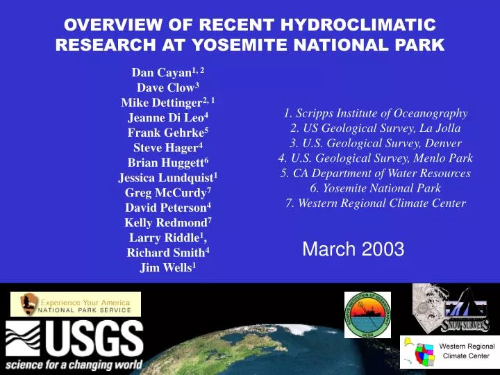
OVERVIEW OF RECENT HYDROCLIMATIC RESEARCH AT YOSEMITE NATIONAL PARK. Dan Cayan 1, 2 Dave Clow 3 Mike Dettinger 2, 1 Jeanne Di Leo 4 Frank Gehrke 5 Steve Hager 4 Brian Huggett 6 Jessica Lundquist 1 Greg McCurdy 7 David Peterson 4 Kelly Redmond 7 Larry Riddle 1 , Richard Smith 4

E N D
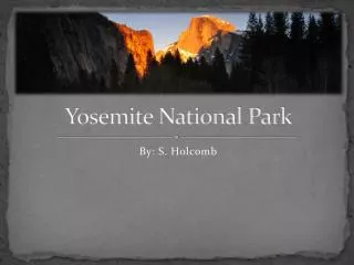
OVERVIEW OF RECENT HYDROCLIMATIC RESEARCH AT YOSEMITE NATIONAL PARK Dan Cayan1, 2 Dave Clow3 Mike Dettinger2, 1 Jeanne Di Leo4 Frank Gehrke5 Steve Hager4 Brian Huggett6 Jessica Lundquist1 Greg McCurdy7 David Peterson4 Kelly Redmond7 Larry Riddle1, Richard Smith4 Jim Wells1 1. Scripps Institute of Oceanography 2. US Geological Survey, La Jolla 3. U.S. Geological Survey, Denver 4. U.S. Geological Survey, Menlo Park 5. CA Department of Water Resources 6. Yosemite National Park 7. Western Regional Climate Center March 2003
California’s hydroclimate and hydrology are notable for their interannual and longer term variability. Cayan et al., in press Meanwhile, climate change--or a pretty good analog--is upon us in the Sierra Nevada. To keep up with climate effects, new and widespread models & measurements will be needed in sensitive high-altitude areas. Observed Fractional Flows!! Dettinger and Cayan, 1995; Cayan et al., 2001
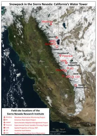
Why have we focused in Yosemite? The Merced & Tuolumne Rivers of Yosemite NP are barometers for streamflow variations across the West, on time scales from days (at least) to decades, … … and, the Merced has one of the longest, pristine high-altitude streamflow records in the West. Peterson et al., 2000
A modeling basis: In the 1990s, to exploit this broad transfer value, and the Merced’s 86-yr record, we developed a detailed watershed model of the basin above Yosemite Valley.
The model has been used to explore the predictability of daily flows, seasonal flows, and major floods of the Merced,…
Dramatic reductions in the “useful” fraction of annual flows from 7 Coupled GCMs … and to project global-change impacts. Dettinger et al., in press Dramatic reductions in summertime moisture availability Dettinger et al., in press
A monitoring thrust: Lundquist et al., in press
Recent (2002) monitoring results: A surprising synchronicity of snowmelt … Altitude Discharge Discharge Day snowmelt begins Julian Date Average springtime Temperatures …turns out to be typical of some springs (including several recent ones), & is attributed to a step-onset of spring warmth. Asynchonous springs Synchonous springs Lundquist et al., in press
Rates of retreat of snowmelt line within basins Diurnal flow cycles are allowing us to use existing streamnetworks to determine river-basin conditions that we never could get at before! Slow vs fast runoff routes of snowmelt Date of change from snowmelt dominance to ET dominance Lundquist & Dettinger, 2003
Continuous stream-chemistry monitoring is allowing us to separate surface and subsurface flow pathways through the Yosemite watersheds. Peterson et al, in review Point stream-chemistry sampling is allowing us to identify atmospheric-deposition hotspots within the Yosemite watersheds.
Where We Are Headed: Science issues Precipitation: Orographic processes? Snowmelt: where/when/how? Linkages: climate–hydrology–ecosystems How will climate change operate? Nature and significance of chemical change? Technical Goals Sierra Nevada transects of -- solar & thermal radiation -- wind -- humidity & vapor transport ….-- precipitation -- stream chemistry -- soil moisture -- snowpack thermodynamics Economical, non-intrusive instruments -- low cost, low power -- miniature, small foot print Real-time Data from wilderness -- digital cellular -- phone line -- satellite Climate-based index stations -- long term, climate quality observations -- focus points for a whole multidisciplinary range of observations & surveys
Some key references: • Cayan, D.R., Kammerdiener, S., Dettinger, M.D., Caprio, J.M., and Peterson, D.H., 2001, Changes in the onset of spring in the western United States: Bulletin, American Meteorological Society, 82, 399-415. • Cayan, D.R., Dettinger, M.D., Redmond, K.T., McCabe, G.J., Knowles, N., and Peterson, D.H., in press, The transboundary setting of California’s water and hydropower systems--Linkages between the Sierra Nevada, Columbia River, and Colorado River hydroclimates, in Diaz, H.F., and Woodhouse, B. (eds.), Climate and Transboundary Issues: 25 p. • Clow, D.W., Mast, M.A., and Campbell, D.H., 1996, Controls on surface water chemistry in the upper Merced River Basin, Yosemite National Park, California: Hydrological Processes, v. 10, p. 727-746. • Dettinger, M.D., Cayan, D.R., Meyer, M.K., and Jeton, A.E., in press, Simulated hydrologic responses to climate variations and change in the Merced, Carson, and American River basins, Sierra Nevada, California, 1900-2099: Climatic Change. • Lundquist, J.D., Cayan, D.R., and Dettinger, M.D., 2003, Meteorology and hydrology in Yosemite National Park: A sensor network application: Proceedings, 2nd International Workshop at Palo Alto Reseearch Center, Information Processing in Sensor Networks, 10 p. • Lundquist, J.D., and Dettinger, M.D., 2003, Linking diurnal cycles in river flow to interannual variations in climate: American Meteorological Society, 83rd Annual Meeting, 17th Conference on Hydology, Long Beach, CA, J2.4-1 to J2.4-5. • Peterson, D.H., Smith, R.E., Dettinger, M.D., Cayan, D.R., and Riddle, L., 2000, An organized signal in snowmelt runoff over the western United States: Journal of Amercican Water Resources Association, 36 (2), 421-432. • Peterson, D.H., Smith, R.E., Hager, S., Huber, K., Dettinger, M., and DiLeo, J., in USGS review, An alpine river chemistry tutorial—Fun with salinity and snowmelt: U.S. Geological Survey Open-File Report. • Wilby, R.L., and Dettinger, M.D., 2000, Streamflow changes in the Sierra Nevada, California, simulated using statistically downscaled general circulation model output, in S. McLaren and D. Kniveton (eds.), “Linking Climate Change to Land Surface Change”: Kluwer Academic Publishers, 99-121. • <<See alsohttp://meteora.ucsd.edu/cap/ & http://water.usgs.gov/nrp/proj.bib/peterson.html>>