Download
1 / 56
560 likes | 780 Views
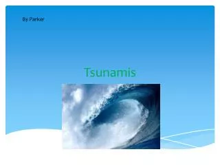
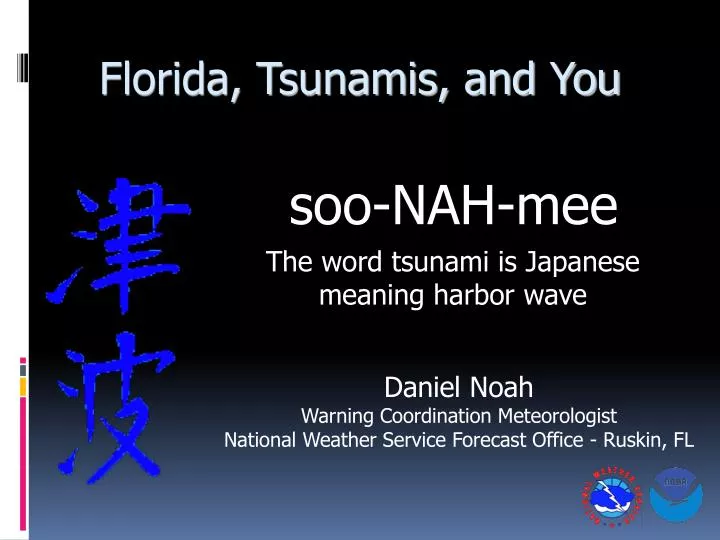
Florida, Tsunamis, and You. soo-NAH-mee. The word tsunami is Japanese meaning harbor wave. Daniel Noah Warning Coordination Meteorologist National Weather Service Forecast Office - Ruskin, FL. What is a Tsunami ?.

E N D
Florida, Tsunamis, and You soo-NAH-mee The word tsunami is Japanese meaning harbor wave Daniel Noah Warning Coordination Meteorologist National Weather Service Forecast Office - Ruskin, FL
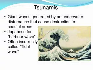
What is a Tsunami? • A series of long waves created by a disturbance that displaces a large amount of water. • Primarily associated with earthquakes in oceanic or coastal regions. • Landslides, volcanic eruptions, nuclear explosions, and even impacts from objects from outer space (such as meteorites, asteroids, and comets)
Wind Waves vs. Tsunamis Wind Generated Waves 5-20 seconds betweenwaves 300-600 ft wave length Tsunami Waves 10 minutes to 2 hours between waves Wave length can begreater than 300 miles
What Happens at the Coastline? • May appear as a rapidly rising or falling tide, a series of breaking waves, or even a bore • Strong currents and debris carried by wave add to destructive nature of this inundating flood
Phuket, Thailand Tsunami December 26, 2004 Photos by German Tourist Hellmut Issels
Phuket, Thailand Tsunami December 26, 2004 Photos by German Tourist Hellmut Issels
Phuket, Thailand Tsunami December 26, 2004 Photos by German Tourist Hellmut Issels
Phuket, Thailand Tsunami December 26, 2004 Photos by German Tourist Hellmut Issels
Tsunami SafetyAll Hazards NOAA Weather Radio • Warns of natural and man made hazards • Alerts you even when you’re sleeping • New radios can be programmed just for your county
Tsunami Safety RulesFor those on the beach • If you feel the earth shake, move immediately to higher ground, DO NOT wait for a tsunami warning to be announced. Stay away from rivers and streams that lead to the ocean if there is a tsunami.
Tsunami Safety RulesFor those on the water • Do not return to port when a Tsunami Warning has been issued • Tsunamis can cause dangerous currents in harbors and ports • If you have time, move your vessel to deep water • Contact the harbor authority to verify conditions are safe before returning
Tsunami Safety RulesFor those on land • Evacuate your house if you live in a hurricane storm surge zone Evacuate vertically if you do not have time to leave the surge zone, move to the highest floor or to the roof Follow the advice of local emergency management and law enforcement officials
For More Information http://tsunami.gov
Causes of Tsunamis • Usually by earthquakes • Less commonly by landslides (into the water and completely below the water) • Infrequently by volcanic eruptions or explosive decompression of underwater methane deposits • Very rarely by a large meteorite impact in the ocean
Earthquake Threat Blue = Mid-Ocean Ridges Red = Subduction Zone
Earthquakes • Tsunamis are created when: • Seafloor quickly changes shape • Water is displaced • Waves are formed as the displaced water mass tries to move back Anthony Liekens
Tsunami Animation, 12/26/04Earthquake 9.0 on Richter Scale near Sumatra Over 160,000 fatalities
Earthquake & Volcano Threat Earthquakes Active Volcanoes
Tsunami Risk by Region1848-1998 O�Loughlin & Lander
Tsunami Risk in Florida • Florida’s Atlantic Coast • Puerto Rico Trench • Cumbre Vieja Volcano in Canary Islands • 1755 Lisbon Earthquake • Azores-Gibraltar fracture zone • Florida’s Gulf Coast and Keys • Puerto Rico Trench (minor effect as wave wraps around islands) • Large Meteorite into Gulf of Mexico
Puerto Rico Trench Michael Count
Regional Plate Tectonics Michael Count
Slope Failure in the Trench Michael Count
Cause of 1918 Tsunami Earthquake, 7.5 on Richter Scale Michael Count
Tsunami Propagation 0 min 2 min 6 min 9 min Michael Count
Run-up Values Michael Count
Tsunami Devastation • Report of large withdrawal of water exposing unseen sediment before tsunami struck the shore • Wave run-up of approximately 20 feet • 116 Deaths • Water traveled 100 meters inland in low lying areas, destroying villages and buildings Michael Count
Cumbre Vieja Volcano in Canary Islands Worst case scenario Wave height in meters Benfield Hazard Research Centre of the University College London
Lisbon Tsunami Travel Times • Florida�s Atlantic Coast • �7-8 hour arrival time • �Estimated 7-10 foot • �Waves every 90 min Dr. Charles Mader, http://www.drgeorgepc.com/Tsunami1755Lisbon.html
Tsunamis vs. Rogue Waves Rogue waves are different the Tsunamis but the end result is similar. Rogue Wave Characteristics • Unpredictable nature • Little is know about the formation • May be caused by regularly-spaced ocean swells that are magnified by currents or the • atmosphere
Daytona Beach Rogue WaveJuly 3, 1992 at 11:30 PM EDT 10:35 PM EDT 50 MPH wind gust at peakof storm 11:35 PM EDT
Daytona Beach Rogue WaveJuly 3, 1992 • 10 ft rise at the beach at 11:30 PM EDT • 75 minor injuries • About 36 vehicles damaged • Swamped shoreline for 30 miles, worst wasfive miles of shoreline near Daytona Beach
Tampa to Naples Rogue WaveMarch 25, 1995 00 UTC 10 UTC
Tampa to Naples Rogue WaveMarch 25, 1995 • Strong outgoing tide at the mouth of TampaBay before an 11 foot rise around 9 AM EST • Tide was 1 to 4 feet above normal south of Tampa Bay to Naples (124 miles of shoreline) • Carried stingrays and jellyfish on thebeach causing people to flee • Wave broke about 1 mile offshore
How Often Can We Expect Tsunamis & Rogue Waves One or two tsunamis each century along the east coast of the U.S. • � Only one Atlantic-wide Tsunami documented(the 1755 Lisbon earthquake) However, Eastern U.S. has had 40 tsunamis/rogue waves in the last 400 years or an average of one coastal flood event every 10 years Lockridge, Whiteside, and Lander
How Do We Detect Tsunamis Deep-ocean Assessment and Reporting on Tsunamis DART Buoy
NWS Tsunami Warning Centers • The West Coast and Alaska Tsunami Warning Center in Palmer, Alaska • Alaska south to California� • U.S. Gulf of Mexico and Atlantic Coast • The Pacific Tsunami Warning Center in Ewa Beach, Hawaii • Hawaii • A national/international warning center for tsunamis that pose a Pacific-wide threat.� • Caribbean
Tsunami Warning ProcessU.S. East Coast & Gulf of Mexico • Interim Method • The Alaska Tsunami Warning Center (ATWC) issues a Tsunami Warning if earthquake 7+ on Richter Scale on/near� a coast • NWS office in Melbourne, FL receives warning via fax and phone call from the ATWC. • NWS Melbourne disseminates warning to coastal NWS Offices via the dedicated Hurricane Hotline • Affected coastal NWS Offices issue a Coastal Flood Warning that triggers • All Hazards NOAA Weather Radios • Emergency Alert System • Statement transmitted over �weather wire� to emergency management officials and the media
Tsunami Warning Statistics�Tsunami Warning Center in Palmer, AK • Warnings are issued within 15 minutes of earthquake and are based solely on seismic data • The average response time was 6.8 minutes in 2003 • Since 1981, 11 regional tsunami warnings have been issued by the WC/ATWC
How can I find out if there is a tsunami warning program in my county?