Download
1 / 33
340 likes | 451 Views
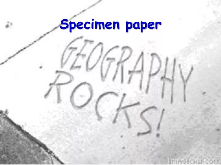
Specimen paper. What this paper looks at. Measuring river features Urban land use Planning and carrying out an investigation. You will be asked to look for a trend or pattern – the answer comes in 2 parts (a) reading the graph (b) explaining what this means

E N D
What this paper looks at • Measuring river features • Urban land use • Planning and carrying out an investigation
You will be asked to look for a trend or pattern – the answer comes in 2 parts (a) reading the graph (b) explaining what this means (c) if more than 4 marks are given, then go for how good the correlation is or anomalies etc As the daily rainfall increases, the maximum temperature decreases. This means that on wetter days it tends to be cooler in summer as there would be less direct sunlight to warm the air. The correlation is quite good for some rainfall, but rain-free days can be both warm and cool One general idea that is like to occur at least once
You will be asked to look for a trend or pattern – the answer comes in 2 parts (a) reading the graph (b) explaining what this means (c) if more than 4 marks are given, then go for how good the correlation is or anomalies etc This one was looking at the daily minimum temperatures last month together with total precipitation – anyone want a go at (a)? And (b)? And (c)? One general idea that is like to occur at least once
River features • What you can measure: • Width • Depth at regular intervals across the width • Velocity of the water at various points and levels • Work out an estimate of cross-section • Work out an estimate of the discharge • Angle of slope • Stone angularity and length • Can’t think of any others right now!
River features we are going to look at today • What you can measure: • Width • Depth at regular intervals across the width • Velocity of the water at various points and levels • Work out an estimate of cross-section • Work out an estimate of the discharge • Angle of slope • Stone angularity and length • Can’t think of any others right now!
Measuring width • The WIDTH of the river channel can be measured by taking a 30 metre tape measure and stretching it from bank to bank. It should be kept as taut as possible to be accurate. If the stream bank is sloping, keep the tape as near to the water surface as you can so that you can line it up with the bottom of the bank. Possible problems: banks overgrown with vegetation may cause problems in terms of finding the exact edge of the stream.
Measuring Depth • Once the tape measure is stretched across the channel, it is easy to move along at regular intervals e.g. one metre, and measure the DEPTH of the stream using a metre rule. Measure depth in metres e.g. 0.25 for 25 cms. so that width and depth measurements are the same units. Regular, accurate readings will allow you to draw an accurate cross-section of the stream channel. Possible problems: large boulders or debris may make the stream very shallow at a particular point - record the reason for this on your data sheet. If the stream bed is soft, the ruler may sink into the mud.
Measuring Velocity • The speed or VELOCITY of the stream can be measured in two ways. If you have a flowmeter, this allows you to take accurate readings at different positions across the stream and also at different depths if you wish. Ideally, you should take at least three readings - in the centre, close to the left bank and close to the right bank. This will allow you to see the effects of meanders on the position of the fastest current. The flowmeter has a propeller which turns in the moving water. The number of turns is recorded on a digital counter.If you do not have a flowmeter, you will need to play 'pooh sticks'. Measure out a length of stream, five or ten metres is ideal. Float a small stick, an orange or similar object along the stream and time how many seconds it takes to get from marker one to marker two. The velocity can be calculated using the formula: speed = distance/time. Ideally, do this two or three times to get an average.Problems: Even expensive flowmeters break down! Floating an object gives surface velocity which is not usually the maximum velocity. It is difficult to get readings close to the banks using floating objects.
The issues • You would expect the velocity to be slower near the bed of the river, next slowest at the surface and fastest in in deeper water – all due to friction. Where the water rubs up against another material ( air or rock), there will be friction – greater with the rock than the air. • So a narrow deep stream will move faster than a wider shallow one. • Taking a measurements at different depths and different points from the banks can give you information. • You may recall that the velocity of a river varies with (a) the steepness of fall (deal with that another day) but also (b) the position on a bend.
The issues • On meanders, water flows fastest on the outside of the bend, and thus can erode the outside more effectively. It is slower on the inside and hence more deposition takes place, leading to river beaches or run-off slope
Qu1. Some IGCSE students wanted to find out how the speed of a river’s flow varied within its channel. • They selected eight sites along the river. At each site, they measured from the left bank the depth of the channel every 0.5 metre across the channel. • (a) Study Figure 1 which shows the channel depths every 0.5 metre across the 5-metre wide channel at Site 1.
(i) Use the data in Figure 1 to draw on Figure 2 the cross-section of the channel at Site 1.
(i) Use the data in Figure 1 to draw on Figure 2 the cross-section of the channel at Site 1. Does yours look like this?
(ii) Mark on your Figure 2 cross-section, the water speeds recorded at Site 1, as shown by Figure 3. (3)
0.2 0.4 0.3 0.1 0.5 0.2 0.1 • (ii) Mark on your Figure 2 cross-section, the water speeds recorded at Site 1, as shown by Figure 3. (3) Does yours look like this?
0.2 0.4 0.3 0.1 0.5 0.2 0.1 • (iii) State the relationship between water speed and channel depth, suggested by this data.(2) • (iv) Explain this relationship.(2)
(c) Study Figure 5, which shows the maximum surface water speeds, measured by the students at each of the eight sites.
(c) Study Figure 5, which shows the maximum surface water speeds, measured by the students at each of the eight sites. • (i) Using data in Figures 4 and 5, complete the scattergraph (Figure 6) to show any correlation between cross-sectional area and water speed.
(ii) Explain what this shows about factors influencing a river’s speed of flow.(6)
What data can be collected in towns • Transect/ground floor count of land use • Interviews to find the range and sphere of influence of particular shops/centres • Pedestrian/traffic count to establish where most movement takes place • Environmental quality surveys • Probably some others but …
What we need to think about today • Transect/ ground floor count of land use • Interviews to find the range and sphere of influence of particular shops/centres • Pedestrian/ traffic count to establish where most movement takes place • Environmental quality surveys • Probably some others but …
What we need to know about towns/cities? • Most towns have a CDB (Central Business District), where you find shops, offices, banks etc. The building are multi-storey and there are few gaps as the price of land is so expensive. • Around the CBD, you have either old industry or older lower class housing or new housing estates and tower blocks. • Beyond this, the housing quality increases as the distance from the CBD increases • Around the edge of towns/cities, you may have a ring road where new shopping centres, industrial parks and more modern housing is being built, all of which benefit from good transport infra structure and the ease of developing on greenfield sites. • Also along major roads, factories and shopping centres may spring up especially if there is no ring road for them to attach to.
Data Collection • Ground floor count of land use: this is one way to establish the main land use for an area, without getting too complicated – it is especially useful in multi-storey multi-occupancy buildings – you merely log what happens at ground level, deemed to be the most important use and ignore anything else. • You can then divide up an area using a grid and note the most common usage in any square. • This gives you a good impression of the general pattern for an area.
Data Collection • Pedestrian Count – this is a precisely timed activity where several counts in different places take place at the same time and for the same length of time. • Often it is done in pairs, with one person counting from left to right and the other counting in the opposite direction. • From this can be established the relative busy-ness of the various points – and can be used by local authority planning departments when they are considering changing paths etc. • Usually the time monitored is 10 minutes. The monitoring must take place at the same time as there are more/less people about at different times/days/weather patterns. • Comparing a wet Monday morning with a sunny Saturday afternoon would not give valid results!
2. An IGCSE student is carrying out an investigation of land use differences, in a town. She starts by obtaining a street map of the town, and then enquires where land values are highest. This point, known as the PLVI (peak land value intersection) became her Site 1. • Study Figure 7 which shows this site and 29 others. These sites numbered 1–30 are survey points for a pedestrian count.
Study Figure 8 which shows the results of these 30 pedestrian counts. • (a) (i) Describe briefly how a pedestrian count is carried out.(2) • (ii) Suggest one difficulty in collecting reliable pedestrian count data.(1) • (iii) Mark the pedestrian counts for each site on Figure 7 and describe the location of the busiest sites. (3)
(b) Study Figure 9 which is a scattergraph. On it, data from Figure 8 about distance from the PLVI and the number of pedestrians are plotted. • (i) Complete Figure 9 by plotting the data for Sites 1 to 6. (3)
Does yours look like this? • (ii) What is the relationship shown by Figure 9? (2)
The last question – worth 1/3 marks! • Is about the practical work that you did! • Some of you have done this in the form I suggested but some of you did something slightly different and did not do any at all. • So you have a problem! • However, there are some cheats available to you – Y10 are doing the new syllabus and while they have no second paper, each module includes some practical work in it so they are beginning to build a stock of assignments, the best of which I will let you look at and see if you can use what they found out to answer all these questions. • One final sources is on the blog – while they were doing a river study, I did one too and explained that as I went which may be another source!
The final question • 3. The early stages of a geographical investigation involve planning and then undertaking the collection of data through fieldwork. • (a) Referring to your own personal experience of fieldwork • (i) State the location of the fieldwork • (ii) State two practical preparations made before carrying out the fieldwork.(2) • (iii) Describe briefly the purpose of the investigation.(2)
The final question • (iv) Draw a labelled sketch-map of the fieldwork location which shows where the data was collected and why the site(s) was chosen.(4) • (v) Describe what data was collected and how it was collected. [You will need to refer to techniques, equipment, time taken and sampling procedures.](6) • (b) Explain in what ways this data collecting stage of the investigation was • (i) successful • (ii) might have been improved • (6) • (Total 20 marks)
If you think you can use your fieldwork to answer these questions , GREAT! • If you think it will not help, try look at some of these: • http://ih-igcse-geography.wikispaces.com/1.10.+River+Coursework • Right at the bottom – Nathan Nick Alec and Callan • Also: http://lindym.wordpress.com/category/coursework/ • Read from bottom to top as I added it a stage at a time! • http://ysgol-rhyngrwyd-igcse.wikispaces.com/Coursework+examples • There are 3 on here from you guys – unfortunately none of them are with us any longer – Lily, Cameron and Tiah