Download
1 / 20
200 likes | 309 Views
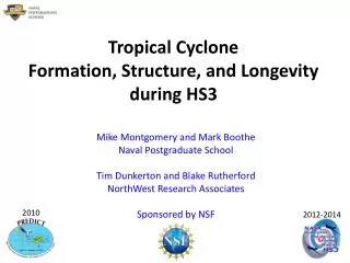
HS3: A Multi-Year Investigation of Hurricane Formation and Intensity Change. PI: Scott Braun Deputy PI: Paul Newman PM: Marilyn Vasques PS: Ramesh Kakar. Overall Science Objective.

E N D
HS3: A Multi-Year Investigation of Hurricane Formation and Intensity Change PI: Scott Braun Deputy PI: Paul Newman PM: Marilyn Vasques PS: Ramesh Kakar
Overall Science Objective • To provide measurements to address key science questions related to storm formation and intensity change, including whether it is primarily a function of the storm environment or storm internal processes
Science Questions—Environment • What aspects of the environment most impact the ability of a tropical storm to form and intensify? • Is the Saharan Air Layer positive or negative influence on storm formation and evolution? Both?
Science Questions—Inner-core • Are convective hot towers actively contributing to storm intensification beyond merely contributing to the total mass flux required for intensification? • Do specific transformations of convective structure occur prior to genesis and rapid intensification?
NASA’s Global Hawk Unmanned Airborne System Hurricane Earl’s eye as seen from the GH Cruise Climb from 56-65K ft (max takeoff weight)
HS3 Mission Overview • Two aircraft, one equipped for the storm environment, one for over-storm flights • Deployments of GHs from the East Coast, likely Wallops Flight Facility in VA • One-month deployments in 2012, 2013, and 2014 • 3-year mission ensures adequate sampling of a wide variety of conditions Dots indicate genesis locations. Range rings assume 30-h flights.
Environmental Payload 2012 2013-2014
Instruments: Cloud Physics Lidar • Cloud/aerosol lidar (CALIPSO simulator) • Instrument PI: Matt McGill, NASA/GSFC • Data: Profiles of atten. backscatter, cloud/aerosol boundaries, optical depth, extinction, depolarization • Horiz., vertical resolution=200 m, 30 m
Instruments: Dropsondes (AVAPS) • Instrument PI: Gary Wick, NOAA • Data: High-resolution vertical profiles of temperature, humidity, pressure, winds • Potentially up to 70-90 drops per flight • New design has flown on GH • Test flights (low, mid, high alt.) completed 2/4/11 • NOAA science flights ongoing
Instruments: Scanning High-resolution Interferometer Sounder • Instrument PI: Hank Revercomb, Univ. Wisconsin • Data: IR TB spectra; Cloud-top temperature, height; sfc skin temperature; profiles of temperature and water vapor in clear-sky conditions • Horiz., vertical resolution=2 km, 1-3 km
Instruments: TWiLiTE Wind Lidar • Instrument PI: Bruce Gentry, NASA/GSFC • Data: Profiles of backscatter intensity, Doppler velocity, horizontal winds in clear-sky conditions • Will fly as part of HS3 in 2013-14 only due to NGC schedule, wind pod availability • Horiz., vertical resolution=~2 km radial winds, 8 km for retrieved horizontal winds, 250 m
15 km 14 km 13 km 12 km 11 km 10 km 9 km 8 km 7 km 6 km 5 km 4 km 3 km 2 km Instruments: High-Altitude MMIC Sounding Radiometer (HAMSR) 3D reflectivity, Hurricane Emily (2005) • Instrument PI: Bjorn Lambrigtsen, JPL • Data: Calibrated brightness temperature; vertical profiles of temperature and water vapor and liquid water; precipitation structure • Horiz., vertical resolution=2km, 1-3 km
Instruments: High-altitude Imaging Wind and Rain Airborne Profiler (HIWRAP) • Instrument PI: Gerald Heymsfield, NASA/GSFC • Data: Calibrated reflectivity, Doppler velocity, 3D reflectivity and horizontal winds, ocean surface winds in precipitation free areas • Horiz., vertical resolution= • 1 km, 200 m for dBZ, Doppler velocity • 1 km, 500 m for horiz. winds • 2 km for surface winds
Instruments: Hurricane Imaging Radiometer (HIRAD) • Instrument PI: Tim Miller, NASA/MSFC • Data: Surface wind speed, rain rate, and temperature; brightness temperature fields at 4 frequencies • Technology similar to NOAA’s SFMR, but scans cross track instead of just nadir • Horiz. resolution=~1.5-2.5 km Example from Hurricane Earl flight during GRIP
HS3 Science Operations Concept • Operations to be closely coordinated with other available aircraft (e.g., NOAA P-3s, G4) to maximize data coverage and continuity, similar to GRIP • Will occasionally fly east of operational aircraft Orange shading is 24-h precipitation
Mission Operations Concept • Initial concept is to fly GHs serially if desired to alternate environment and over-storm sampling • Manpower, cost, potential FAA issues make simultaneous flights unlikely • Can have one GH coming back while the other is going out • Turn-around time for either GH (landing to next takeoff ~24-48 h • 300 total science flight hours per deployment Division between the aircraft will depend on science goals and weather
HS3 Applications • Goal: To make data widely available for • Hurricane research • Satellite calibration/validation activities (GPM, NPP, GOES-R) • Model improvement research (DA, microphysics) • Collaboration with HFIP • Would like to collaborate with NHC to develop useful real-time products
HS3 Data Plan • All data to be publically available • Some data products to be made available in real time • Following each deployment, ~6-9 months for data QC, processing • Links to data, as well as all mission information, at www.espo.nasa.gov/hs3/
Questions? www.espo.nasa.gov/hs3/