Download
1 / 29
310 likes | 486 Views
A presentation - invoking the physical science - on how climate change may impact Latin American people , resources, and livelihoods, in order to provoke discussions on how to get a move within Latin-American communities, inside and also outside USA.

E N D
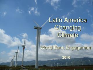
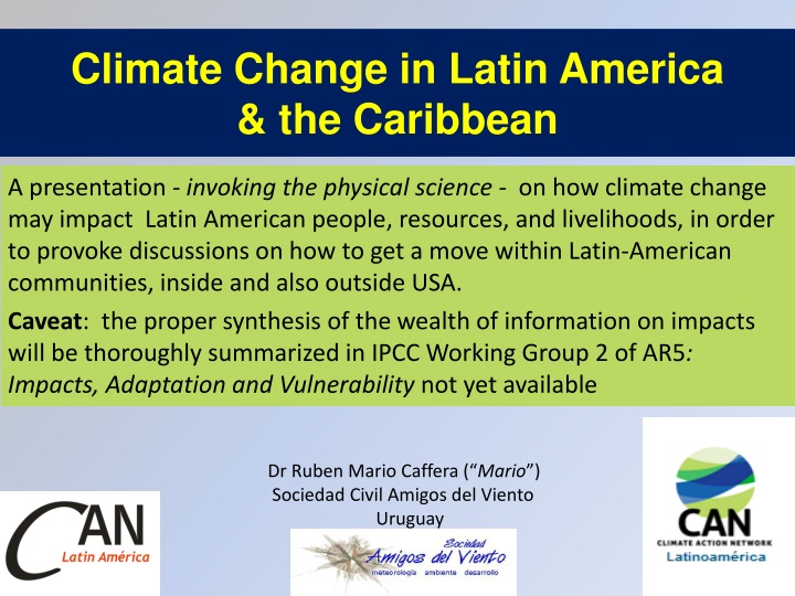
A presentation - invoking the physical science - on how climate change may impact Latin American people, resources, and livelihoods, in order to provoke discussions on how to get a move within Latin-American communities, inside and also outside USA. Caveat: the proper synthesis of the wealth of information on impacts will be thoroughly summarized in IPCC Working Group 2 of AR5: Impacts, Adaptation and Vulnerability not yet available ClimateChange in LatinAmerica& theCaribbean DrRuben Mario Caffera (“Mario”) Sociedad Civil Amigos del Viento Uruguay
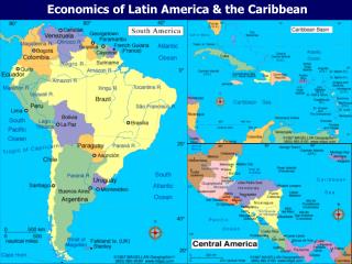
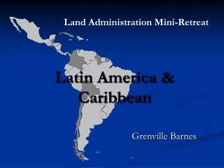
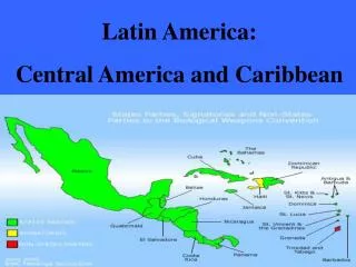
Latin American & CaribbeanCountries 14 organizations in 12 countries (from 32) belongto CAN, throughthe CANLA node
IPCC AR5 WGI format figures output A shift in theprospectiveemissionscenarios: Representative Concentration Pathways (RCPs) RCPs complement and, for some purposes, are meant to replace earlier scenario-based projections of atmospheric composition, such as those from the Special Report on Emissions Scenarios (SRES; Nakicenovic and Swart 2000). The RCPs are being used to drive climate model simulations planned as part of the World Climate Research Programme’sFifth Coupled Model Intercomparison Project (CMIP5) (Taylor et al. 2009)
IPCC AR5 WGI format figures output Eachone of theThreeRegionswere sub-dividedin two sub-regions in theproper IPCC Report. So wedidthesamein many of the following diapos..
Sea levelrise. South America - IncreasingtheProbability of CoastalHazardsby 2040 (%) % of inhabitantsreachedbythehazards Increase of risk in maritimeworks (docks, etc) EspeciallySouthernBrazil and Peru (UN/ECLAC)
UN/ECLAC loss ratio (when >1, itmeansverylow-risk) • ThreatedShores • Mexico (Baja Calif. & Pacific) • Salvador, Pacificshores in Honduras, Nicaragua, Costa Rica and Panama • NW CaribbeanIslands (big & small) • Manyshorelines in Colombia, Ecuador & Peru • Venezuelan extreme Eastern shore, Surinam coastline, northernBrazil (“costa mosquito”) • SouthEast & SouthernBrazil and Atlant. Urug
Southern South AmericaSea-level rise • - Changing sea levels and ocean currents will affect the location of fish stocks in the south-east Pacific(e.g., in Peru and Chile) and thus food security (Magrin et al. 2007) (as in ENSO warm events) • Increased salinization and reduced freshwater availability along coasts (Klein and Nicholls, 1999; Sherifand Singh, 1999; Essink, 2001) that means: • Increased damage to water supply and sanitation services in coastal cities, as well as groundwater contamination by saline intrusion (Magrin et al. 2007)that could be a generalized threat. • - Sea level rise and storm surges will impact coastal areas including developed urban areas, and infrastructure particularly in low-lying areas • Brazil has the largest number of inhabitants in lower levels followed by Argentina, both having the major vulnerable coastal linear infrastructure • The distribution of ecosystems varies greatly between dimensions, countries and levels. To Brazil belongs the higher economic value of coastal ecosystems in absolute magnitude, but every Latin American country has vast regions with very important ecosystemic services
WEST COAST & SOUTHEASTERN SOUTH AMERICA 4RCPscenarios 2015-2035EXPECTED CHANGES IN PRECIPITATION April-September • (LEFT) precipitationchanges (%) withrespectto1986-2005 average in the WEST COAST • (RIGHT)samebutfor SOUTHEAST REGION. Boldlines: CMPI5 multimodelaverages • BELOW precipitationchangeswithrescpectto 1986-2005 with RCP4.5 scenarioforthe 25, 50 & 75 percentiletheCMIP5 ensemble, natural variability and propagationamongmodels. Dashareas: wherediscrepanciesbythemodel s values are lesserthanthe natural Standard Deviation in thepreceeding 20 years.
WEST COAST & SOUTHEASTERN SOUTHAMERICA 4RCPscenarios 2015-2035 AIR SURFACE TEMPERATURE EXPECTED CHANGES Diciembre-Febrero (LEFT) temperaturecangeswithrespect 1986-2005 average, West Coast (land) (RIGHT)thesame, forSouthEastern S. A:. Boldlines: CMPI5 multi-modelaverages BELOW temperaturechangeswithrespectto 1986-2005 withthe RCP4.5 scenarioforthe 25, 50 and 75 percentil in theCMIP5 ensemble, naturalvariability and propagationbetweenmodels • Dashedareas -differencebetweenboth 20 yearperiods (recordedvs. model) are lessthanthe Standard Deviation of the 20 yearcurrentmeans. Evaporation increase Glaciers’ thaw
Southern South America (cont) Temperature: - Warmest daily maximum temperature is projected to increase 3-5°C - Number of tropical nights (number of 24-hour days above 20°C) is projected to increase from between 1 and 100 days, with most of them pronounced in the northern portion of the region (Peru, Bolivia, Brazil, Paraguay). In northern Uruguay, that’s currently happen, & frost winter nights are reducing its frequency. Implications - risk of vector-born diseases for humans, cattle and crops: dengue fever is spreading in many parts of Argentina-Paraguay-Brazil, horse-fever reaches Patagonia, transmitted by a mosquito who belongs to high plateaus from southern Brazil, yellow-fever are reaching southern Brazil too
Southern South America: rain & waterresources - Mid-term (2046–2065) 20% decrease to 20% increase in March-May. The decrease is more pronounced across the southern portion of the region (Chile, Argentina) and central Brazil, while the increase is more pronounced over the northern portion of the region (Peru, Ecuador, Bolivia, Uruguay) - Precipitation is projected to increase across the western portion of the region (Brazil, Uruguay, implying more soil erosion) by the end of the century, but decrease in the southwestern portion (Chile, southern Argentina) - Decrease in cloudiness and humidity in the South of the region (Chile, Argentina) and in the northern portion of the region (Peru, Bolivia, Brazil), with an increase of cloudiness and humidity in Uruguay (facilitating potato blight (remember Ireland) and other crop diseases) - Decrease in annual mean soil moisture in much of the southern portion of the region (Chile, Argentina) and an increase in Uruguay, Paraguay, and portions of Brazil and Argentina - Increase of up to 40% in annual runoff for the western portion (Brazil, Uruguay, Paraguay) and decreases of up to 40% for the northwestern portion (Chile, Argentina), menacing hydropower
Southern South America(cont: Food Security) -Decreased food security and exacerbated malnutrition due to greater climatic variability, most notably from heatwaves and ElNiño/LaNiña events , on cotton and mangos on the northern coast of Peru (Torres et al., 2001)1; citrus in Argentina (Canteros et al., 2004); wheat in Brazil and Argentina (Moschini et al., 1999; Del Ponte et al., 2005); and maize, potato, wheat and beans in Peru (Torres et al., 2001); crops(Travasso et al., 2003a), and dairy(Valtorta et al., 2004) in the Pampas region of Argentina. - Increased risk of Fusariumblight incidences in wheat crops in south Brazil & Uruguay(Fernandeset al. 2004) & potato diseases(already mentioned) - Increase in pasture productivity between 1% -9% in some temperate areas, such as the Argentinean and Uruguayan Pampas (Gimenez, 2006) (I doubt it: winter temperate grass species replaced by subtropical biannual ones could provoke a lack in wintertime gain of weight in cattle stock) - Decrease in beef cattle weight (and production) of up to 20% in Bolivia with a warming of 4°C, depending on animal genotype/region (Nat.Comm. 2000) 1“Modoki”El Niño, whose happening and discover occur after 2004 is not taken into account in this paper
AMAZONIA & BRAZILEAN NORTHEAST in 4 RCP scenarios2015-2035EXPECTED AIR SURFACE TEMPERATURE CHANGESDecember-February • (LEFT) relativetemperaturechangesform1986 - 2005 inAmazonia. • (RIGHT)thesamebutforNorthEastBrazil. Boldlines: CMP5 multimodelaverages • BELOW temperaturechanges in 2016-2035 withrespectto 1986-2005 in the RCP4.5 scenarioforthe 25, 50 & 75 percentiles in the CMIP5 ensemble, natural variabilityand propagationbetweenmodels • Dashedareas- differencebetweenboth 20 yearsperiod (recorded vs. & model) are lessthanthe Standard Deviation of the 20 yearcurrentmeans …
AMAZONIA & BRAZILEAN NORTHEAST in 4 RCP scenarios 2016-2035 EXPECTED AIR SURFACE TEMPERATURE CHANGESJune-August • (LEFT) relativeprecipitationchangesform1986 - 2005 in Amazonia. • (RIGHT) thesamebutforNorthEastBrazil. Boldlines: CMP5 multimodelaverages. • BELOW precipitationchanges in 2016-2035 withrespectto 1986-2005 in the RCP4.5 scenarioforthe 25, 50 & 75 percentiles in the CMIP5 ensemble, natural variabilitynandpropagationbetweenmodels • Dashedareas - differencebetweenboth 20 yearsperiod (recorded vs. & model) are lessthanthe Standard Deviation of last 20 yearcurrentmeans …
AMAZONIA & BRAZILEAN NORTHEAST in 4 RCP scenarios 2016-2035 EXPECTED PRECIPITATION CHANGESOctober-March • (LEFT) relativeprecipitationchangesform1986 - 2005 in Amazonia. • (RIGHT) thesamebutforNorthEastBrazil. Bold line: CMP5 multimodelaverage. • BELOW precipitationchanges in 2016-2035 withrespectto 1986-2005 in the RCP4.5 scenarioforthe 25, 50 & 75 percentiles in the CMIP5 ensemble, natural variabilitynandpropagationbetweenmodels • Dashedareas - differencebetweenboth 20 yearsperiod (recorded vs. & model) are lessthanthe Standard Deviation of last 20 yearcurrentmeans …
AMAZONIA & NorthEASTERNBrazil in the 4 RCP scenarios 2015-2035EXPECTED PRECIPITATION CHANGES APRIL-SEPTEMBER • (LEFT) relativeprecipitationchangesform1986 - 2005 in Amazonia. • (RIGHT) thesamebutforNorthEastBrazil. Bold line: CMP5 multimodelaverage. • BELOW precipitationchanges in 2016-2035 withrespectto 1986-2005 in the RCP4.5 scenarioforthe 25, 50 & 75 percentiles in the CMIP5 ensemble, natural variability and propagationbetweenmodels • Dashedareas - differencebetweenboth 20 yearsperiod (recorded vs. & model) are lessthanthe Standard Deviation of last 20 yearcurrentmeans …
Projected Climate Changes in Northern South America Temperature · Mid-term (2046–2065): increase of 2°C; Long-term (2081–2100): increase of 3-5°C or more · The warmest daily maximum temperature is projected to increase 4-7°C! · N° of tropical nights (days with 24-hour above 20°C) projected to increase from between 1 and 100 days, most along the western coast (Colombia, Ecuador, Peru) and in the southern portion (Brazil, Bolivia) very dangerous for mammals, human included Precipitation · Mid-term (2046–2065) decrease more than 20% in December-February over the northeastern portion of the region (Venezuela, Guyana, Suriname), while the increase is more pronounced over the southern and western portion of the region (Brazil). Up to 30% decrease during September- November, concentrated in the southeast portion (Brazil) damaging national efforts to develop de “Sertao” region. - Long-term (2081–2100. Up to 50% decrease in September - November, most pronounced over the Brazilian portion. Huge damaging societal aims -Decreasing cloudiness and humidity over the land masses in the region desertification - Decrease in annual mean soil moisture of up to -2 mm across much of the region but especially in the northeast portion (Brazil, Venezuela, Guyana, Suriname, French Guiana). HUGE desertification when combined with deforestation! and · Increase 10% in annual runoff for the western portion (Colombia, Ecuador, Peru) and decreases of up to 30% for the northwestern portion (Venezuela) and parts of Brazil
Projected Climate Changes in Northern South America · Decreased precipitation during June – August (Hesselbjerg Christensen et al. 2013) in Northeast Brazil (crops hazards) · La Niña-induced extreme floods are also expected and could lead to widespread destruction and costs (Waylen and Poveda, 2002): Hydropower -the main electrical energy source for many countries in Latin America, vulnerable to large-scale and persistent rainfall anomalies during ElNiño/LaNiña in Colombia , Venezuela, Peru , and Brazil · Continued loss of snow and glacial cover in Peru, Colombia, Ecuador and Bolivia, will negatively impact water supplies for irrigation, clean water supply for people (Quito), and hydropower generation (La Paz and Lima) Food Security · Decreased food security and exacerbated malnutrition due to greater climatic variability, most notably from heatwaves and ElNiño/LaNiña events for cotton and mangos on the northern coast of Peru (Torres et al, 2001); wheat in Brazil (Moschini et al., 1999; Del Ponte et al., 2005); and maize, potato, wheat and beans in Peru (Torres et al 2001) · Increase in the frequency and intensity of extreme events: heatwaves, floods, droughts, will adversely impact agriculture throughout the region (Magrin et al. 2007) · Incidences of the coffee leafminer (Perileucopteracoffeella) and the nematode, Meloidogyne incognita, are likely to increase in future in Brazil’s production area. The number of coffee leafminer cycles could increase by 4%, 32% and 61% in 2020, 2050 and 2080, respectively, under business-as-usual scenarios (Ghini et al., 2008) (business & jobs)
Projected Climate Changes in Northern South America • Human Health • Climate-induced droughts associated with El Niño may lead to increased risk of malaria epidemics in coastal regions of Colombia and Venezuela (Poveda et al., 2001; Kovats et al., 2003) • Climate-induced flooding can increase malaria epidemics in the dry northern coastal region of Peru(Gagnon et al., 2002) • Climatic variability can lead to increased outbreaks of hantavirus pulmonary syndrome in Bolivia, Panama and Brazil(Williams et al., 1997; Espinoza et al., 1998; Pini et al., 1998; CDC, 2000) • Prolonged droughts in semi-arid northeastern Brazil have caused a rural to urban migration of subsistence farmers, and a re-emergence of visceral leishmaniasis(Confalonieri, 2003), and extreme temperatures will also increase morbidity in vulnerable populations (Confalonieri et al. 2007) • But in Brazil, thebigpicture are alsotheawfulshifts in federal lawsassumedtoprotectjunglefromdeforestation and aforestation, and coal & shaleminingprocedures.
Sea levelrise : IncreasingtheProbability of CoastalHazardsby 2040 (%) Increase of risk in maritimeworks (docks, etc) Especially Baja California (UN/ECLAC) % of inhabitantsreachedbythehazards
4 RCP scenarios in CENTRAL AMERICA & CARIBBEAN (2015-2035) EXPECTED CHANGE IN AIR TEMPERATURE December-February (LEFT) temperaturechangefrom1986-2005 averageoverland in CentralAmerica (RIGHT)thesamebutfortheCaribbean(land and sea) bold line: multimodelaverage CMIP5. BELOW Temperaturechanges 2016-2035 vs 1986-2005 with RCP5 scenario. Forthe 25, 50 y 75 percentilefromthe CMIP5 ensemble, natural variability& in-betweenpropagationmodels
4 RCP scenarios in CENTRAL AMERICA & CARIBBEAN 2015-2035EXPECTED CHANGE IN AIR TEMPERATURE June-August • (LEFT) temperaturechangefrom 1986-2005 averageoverland in Central America • (RIGHT) thesamebutfortheCaribbean (land and sea) bold line: multimodelaverage CMIP5 • BELOW Temperaturechanges 2016-2035 vs 1986-2005 with RCP5 scenario. Forthe 25, 50 y 75 percentilefromthe CMIP5 ensemble, natural variability & in-betweenpropagationmodels .
AMERICA CENTRAL Y EL CARIBE en los 4 escenarios de RCP (2015-2035) 2015-2035 EXPECTED PRECIPITATION CHANGES October-March • ((LEFT) Precipitationchangefrom 1986-2005 averageoverland in Central America • (RIGHT) thesamebutfortheCaribbean (land and sea) bold line: multimodelaverage CMIP5 • (BELOW) Precipitationchanges 2016-2035 vs 1986-2005 with RCP5 scenario. Forthe 25, 50 y 75 percentilefromthe CMIP5 ensemble, natural variability & in-betweenpropagationmodels .
Precipitation changes for Central America and Caribbean in 2080–2099 vs. to 1986–2005 Rainyseason Light hatching denotes where more than 66% of models have the same sign with the ensemble mean changes. Dense hatching denotes where more than 90% of models (or members) have the same sign with the ensemble mean changes SRES A1B/24 CMIP3 models (left), RCP4.5 /39 CMIP5 models (middle). Right: precipitation change 2075-2099 vs. 1979-2003 in SRES A1B /12 members 60km mesh MRI-AGCM3.2 multiphysics, multi-SST ensembles (Endo et al., 2012).
Central America & theCaribbean(cont) • NICARAGUA" ... Climate change is a reality that is impacting the quality of life and safety in Latin American countries ... " • Human health. Apparently controlled epidemic (dengue ), pest of rats are increasing, so damage to livelihoods: losses due to floods and droughts • After hurricane Mitch it was observed the largest Central American migration to the USA • Internal migration is also observed - contrasts between regions of the same country exist, not only resource-related but also to the plot, to the social tissue are exerting social pressures migrating even to protected areas (Bosawás protected region invaded by thousands of settlers) • Complex emergencies are occurring: Invasions of properties, tribal conflicts and resource wars . (Water , oil, etc.) • Unemployment& food shortages is more pressing after each extreme climate issue Moisés A. GonzálezRegional component of the Resilience Advocacy ProjectDrought by the Coalition for Regional Risk Management /Centro Humboldt, in consortium with Action Against Hunger-International /Centro Humboldt Plan under the 2013 HIP-ECHO
Central America & theCaribbean(end) • In Northern Latin America, Mexico has the largest number of inhabitants in lower levels (and Brazil and Argentina at the southern extreme) • In relative terms to the population of each country, the Turks and Caicos Islands, Cayman Islands and the Bahamas have all its population concentrated in the first 10 m of height • The highest density of population in the coastal lowlands is in Barbados, Granada , the US’s Virgin Islands and Dominica. This variable represents the concentration of the population in the first meters of elevation of the coast and is especially important to consider in adaptation strategies. • The most vulnerable countries with coastal linear infrastructure are Mexico, Brazil, Cuba, Bahamas and Argentina • The distribution of ecosystems varies greatly between countries and levels . Brazil and Mexico are the countries that have achieved higher economic value of coastal ecosystems in absolute magnitude, followed by Cuba , Colombia , Nicaragua and Honduras , all such countries with much smaller area than the previous two. (Costa Rica has its precious ecosystems at higher elevations)
A dilemmafor ENGOS The increased frequency of Extreme Events1 might not be attributed to climate change, so: ¿have we the right to put the world on alarm each time a Hurricane blast some country? 1This does not means that the increase had not been registered. This bias in the projections of 2007 does not mean that the direction of the projection wasn’t true - I would like to highlight the fact with an example: Columbus missed on the size of the Earth’s diameter, but there is no reason to affirm by that way that the planet is flat and not round like Columbus said . (the egg affair)
Thankyou! (thanks a lot) Dr R. Mario Caffera http://amigosdelviento.webs.uy