Download
1 / 7
70 likes | 81 Views
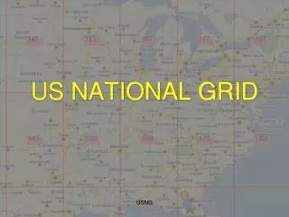
U.S. National Grid. Proposed standard for public comment FGDC Standards Working Group 06 FEB 01. What is it?. A process/ presentation standard Location referencing Specific to the human interface Single preferred method UTM /MGRS based. What’s the benefit?. Map interoperability

E N D
U.S. National Grid Proposed standard for public comment FGDC Standards Working Group 06 FEB 01
What is it? • A process/presentation standard • Location referencing • Specific to the human interface • Single preferred method • UTM/MGRS based U.S. National Grid
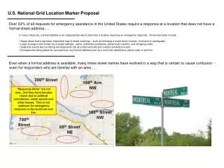
What’s the benefit? • Map interoperability • Analog / analog • Analog / digital • Enhances national disaster response • Enables location-based service industry • Provides alternative geo-indexing solution U.S. National Grid
Who’s effected? • Some map publishers • Feds – mandatory • Non-Feds – voluntary • Some appliance manufacturer’s • Some commercial software vendors • Most map / GIS users U.S. National Grid
How did it happen? • An old question • 1997 ASPRS discussions • Public X-Y Mapping Project formed • Tests and surveys • 1998 FGDC proposal • SWG Ad Hoc Working Group • 2001 Public review U.S. National Grid
Who did it? Public X-Y Mapping Project GPS Industry Trimble Magellan Motorola GPS Industry Council FGDC USACE NIMA USGS NGS Commercial GIS OpenGIS Consultants Private Mapping Rand McNally Academia U of Georgia U.S. National Grid
What next? • Today’s approval - 7 • Test assumptions - 8 • Validate technical approach - 8 • Evaluate and Revise - 9 • SWG & CG final approvals – 10 & 11 • SC approval & publish - 12 U.S. National Grid