Download
1 / 48
480 likes | 674 Views
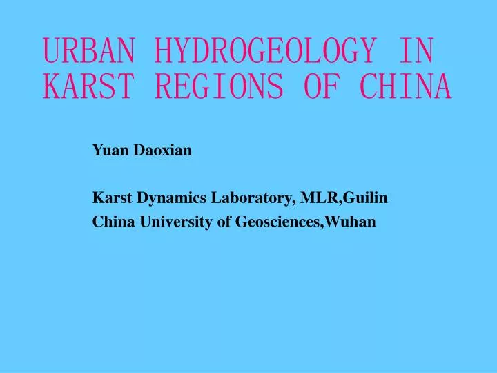
URBAN HYDROGEOLOGY IN KARST REGIONS OF CHINA. Yuan Daoxian Karst Dynamics Laboratory, MLR,Guilin China University of Geosciences,Wuhan. Contents. * Introduction:Urbanization in China * Functions of Cities in Karsts of China * Urban Hydrogeological & Environmental Problems

E N D
URBAN HYDROGEOLOGY IN KARST REGIONS OF CHINA Yuan Daoxian Karst Dynamics Laboratory, MLR,Guilin China University of Geosciences,Wuhan
Contents * Introduction:Urbanization in China * Functions of Cities in Karsts of China * Urban Hydrogeological & Environmental Problems * Concluding Remarks
I, INTRODUCTION: URBANIZATION IN CHINA *1980s: medium size cities: from 180 to 400 *2000: 666, 32 having population more than a million *Urbanization as a strategic measure : for economic development; to reduce the differences between developed and poor regions
II, FUNCTIONS OF CITIES IN THE KARST OF CHINA • Karst in China(including buried and covered karst): 3,463,000 km2 , i.e, 1/3 of its territory • Exposed karst: 907,000 km2
Provincial Capitals: • Jinan,Shandong province • Taiyuan, Shanxi province • Kunming, Yunnan province • Coal Industrial Cities: • Jiaozuo, Henan province • Zibo,Shandong province
Industrial centers • Zunyi, Guizhou province • Liuzhou, Guangxi province • Agriculture • Most of the medium and small size cities are based on local agriculture,but some of them enjoy special products, such as: • Sugar cane: Guigang,Guangxi • Tobacco : Menzi,Yunnan province
Fig.4, Menzi Basin • Chile pepper: Qiubei,Yunnan province
Fig.5, green house nursery of chile pepper • Grape & Wine: Mile,Yunnan
Fig.6,Grape yard in Mile county,Yunnan • Herb Medicines:Wenshan,Yunnan
Mineral Deposits • Cassiterite: Gejiu,Yunnan • Dachang,Guangxi • Lead-Zinc: Siding,Guangxi
Fig.8, Surface collapses around Siding City, induced by dewatering in the underlying lead-zinc mining tunnels
Tourisms • Fig.9,Stone Forest, Lunan,Yunnan • Fig.10, Tropical Karst, Guilin, Guangxi • Fig.11,Jinci Karst Springs,Taiyuan, Shanxi
III, URBAN HYDROGEOLOGICAL &ENVIRONMENTAL PROBLEMS • The exploitation of natural resources (water,land,mineral deposits, coal, and touristic attractions) benefits the urbanization of karst regions. But hydrogeological and environmental problems,even geological hazards may happen when there is an ignorance of scientific management, which need a good understanding on the karst hydrological system.
Coastal Cities • Sea water intrusion in coastal regions of Dalian city,Liaoning province,NE China • Fig.12,Karst geological section across Dalian city
1,caves; 2,coastal erosion cavities; 3,coastal erosion columns; 4,through cave; 5,coastal erosion platform;6,coastal springs; 7,submarine karst springs; 8,S, S1, S2, coastal terraces • Fig.12,Karst geological section across Dalian city
Fig.13, A view on the eastern coast of Dalian,Liaoning,NE China
Cities in the Karst Lowland of Eastern China • Over extraction of groundwater brings about drying of karst springs with touristic attraction:e.g,Jinan, Shandong province • Fig.14, Karst hydrogeological cross section of Jinan city • Fig.15,Karst hydrological variation in Jinan city during the past 40 years
Fig.15,Karst hydrological variation in Jinan city during the past 40 years (Xi Deyin,1988) • 1,precipitation; 2,spring flow;3,water table;4,amount of extraction in urban area;5,sum of extraction and spring flow
The Baotu Spring and more than 70 other karst springs which used to flow out around downtown Jinan city,with a total discharge of 300,000 to 350,000 m3/day before 1970s. • Stopped flowing when the extraction from the Ordovician karst aquifer underlain the city was more than 270,000 m3/day.
*A karst collapse happened in Tai’an city,January,1979,right below the major railway between Beijing and Shanghai. • Fig.16, karst collapses in Guizhou and Guangxi
Cities on the plateau karst, middle of China • Shanxi province,North China • Permo-Carboniferous coal measures, the most important energy source of China,are overlying the major karst aquifer (Cambrian-Ordovician) • Fig.17,Schematic hydrological profiles showing the general relationship between karst aquifer and coal measures in North China
Fig.17,Schematic hydrological profiles showing the general relationship between karst aquifer and coal measures in North China (Han Xingrui,1994)
The development of coal industry brings about pollution to the underlying karst aquifers, the major source of urban water supply.
Southwest China Karst Plateau • Cenozoic uplift,and development of underground karst drainage systems bring about:-- • Fig.18,Hydrological profile of Menzi Basin, a typical example to show the relationship between land , cities and underground streams
Fig.18,Hydrological profile of Menzi Basin, a typical example to show the relationship between land , cities and underground streams
*WATER SOURCE PROBLEM • Land and cities are usually distributed on the denudation surfaces of different altitude, but underground streams are dozens to hundreds meters below land and cities. How to find enough water to support the city development is always a challenge.
*FLOOD PROBLEMS • When underground streams are not able to drain away excess storm water, flood happens on the surface • Fig.19, Hydrogeological section of Gejiu city,flooded in 1954 • Fig.20, Flood in Sanshi polyje, Donglan County, Guangxi
1.Metamorphic rock; 2.Granite; 3.Karstified limestone; 4.Argillaceous rock • Fig.19, Hydrogeological section of Gejiu city,flooded in 1954
*POLLUTION • Fig.21,Shuicheng city,Guizhou,1800m asl,polluted waste water from coal mining,and steel manufactory draining into underground streams
位置 COD BOD5 Phenol CN- As Cd Cr6+ Pb NO3- 水钢出口 1.68 1.54 22.4 0.22 0.68 0.9 0.15 1.26 1.26 落水洞(1983年) 0.66 0.37 4.1 0.06 0.14 0.24 0.90 0.30 0.12 落水洞(1990年) 1.91 0.51 14.1 2.79 0.14 1.14 3771 0.50 0.48 窑上水库 0.2 0.45 0 0 0 0 0.18 0.04 0.1 • Fig.21,Shuicheng city, Guizhou, 1800m asl, polluted waste water from coal mining, and steel manufactory draining into underground streams • (Yao Chenghong,2002)
IV, CONCLUDING REMARKS • For sustainable development of water resources in urban areas of karst in China,it is necessary:-- • 1, to get a better understanding on karst hydrological systems with respects to coastal, lowland and plateau areas of China;
2,to take into account protecting scenic attractions and ground stability while exploiting resources. • Fig.22, The relationship between Boyue Cave system,Hunan and the coal measures underlain
1,Middle-Lower Carboniferous limestone; 2,Lower Carboniferous coal measures; 3,Lower Carboniferous Limestone • Fig.22, The relationship between Boyue Cave system and the coal measures underlain
3, to address properly the relationship between landuse planning/management and karst aquifer protection • Fig.23, Landuse along the Baiyandong underground stream,Baojing,Hunan
Fig.23, Landuse along the Baiyandong Underground stream,Baojing,Hunan
4,to carry out vulnerability assessment and mapping for karst aquifers • Fig.24,Vulnerability map of karst water in Houzai underground stream,Puding, Guizhou
Fig.24,Vulnerability map of karst water in Houzai underground stream, Puding,Guizhou