Download
1 / 42
420 likes | 510 Views
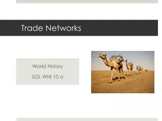
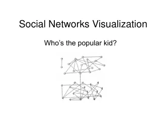
Approaches to Visualization of Trade Networks. Ryan Denniston Duke Data Visualization Friday Forum November 16, 2012. Outline. The nature of the problem(s) Non-spatial approaches (Excel) Spatial approaches (ArcGIS) Sharing options. The Project.

E N D
Approaches to Visualization of Trade Networks Ryan Denniston Duke Data Visualization Friday Forum November 16, 2012
Outline • The nature of the problem(s) • Non-spatial approaches (Excel) • Spatial approaches (ArcGIS) • Sharing options
The Project Political economy of tobacco control in Southeast Asia • Southeast Asia increasingly wealthy, one of the few areas with low female prevalence
The Project Political Economy of tobacco control in Southeast Asia • Liberalized markets heighten importance of trade to health outcomes • Principal origins and destinations of cigarettes within and from outside the region • Especially large flows, indicative of transit points • Trade discrepancies, suggesting smuggling activity • Regional manufacturing hubs
The Project ASEAN Region – AFTA operational in 1996
The Nature of the Problem Provide a clear understanding of the underlying data • How important are the methods for the results? • Case selection (year, categories, etc.) Effective communication to applied audiences • Visible impact with minimal explanation • Compelling • Mitigation of data anomalies (missing data, etc.) Balance between comprehensiveness and complexity • At what point is the visualization overwhelming? • Who is the audience?
Project Data Data • Time series, cross sectional (annual) • Multiple levels of analysis • Typical sources: UN Comtrade, FAO Bilateral Trade Data
Non-Spatial Examples – Grouped Bars • Visualizes relative positions of cases • Year and case selection not apparent • Single variable, no groupings without data manipulation
Non-Spatial Examples – Stacked Column • Visualizes relative positions of cases • Year selection not apparent
Non-Spatial Examples – Line Charts • Limited case selection • Outliers and volatile data may cause problems
Non-Spatial Examples - Tradeoffs Problems • Data volatility when range of years displayed • Outliers distort when multiple cases displayed • Repeated cross-section (year selection) • Limited number of cases due to complexity • Others?
Spatial Examples – GIS Software ArcGIS essentially Excel with a column containing a shape (set of ordered coordinates) • Qgis is an alternate program • Recent tools launched to plot spatial data (addresses, lat/lon, some polygon sets, custom boundaries)
Spatial Examples Potential problems • Year-over year volatility • Threshold selection (across cases and over time) • Zero value, not available • Time series, ArcGIS does not sense minimum and maximum • Trade networks at different level of analysis Levels of analysis • Freeze one country, report its bilateral values over time • Find or create new layer at correct level of analysis
Spatial Examples – Bilateral Trade http://www.duke.edu/~rcd2/2.avi
Spatial Examples – Bilateral Trade http://www.duke.edu/~rcd2/4-incomplete.avi
Spatial Examples Problems • Volatility of data remains • Tradeoff between complexity and comprehensiveness • Threshold selection • Stability possible with grouping, data transformationhttp://www.duke.edu/~rcd2/Untitled.avi
Spatial Examples ArcScene is a 3D visualization and analysis program bundled with Map. Designed for x y z data, but can be coerced to multidimensional data. Mathematica, R, Matlab are other, likely better alternatives
Tableau 7 - Sharing http://public.tableausoftware.com/views/ag_nc/Sheet1
Tableau 7 – Custom Layers http://public.tableausoftware.com/views/autos_test_1/Sheet1?:embed=y
ArcGIS Online https://dukeuniv.maps.arcgis.com/explorer/?open=213f0e846ea84d03b198b9339645a936&extent=-8797614.54634536,4293258.24833525,-8771524.04069068,4306656.81009333 http://people.duke.edu/~rcd2/arcgis.html
ArcGIS Online – Multiple Layers and Types https://dukeuniv.maps.arcgis.com/explorer/?open=e43f3f5ef5b74d70b67ce9a9c49eef24&extent=-4388260.72929949,3794930.68242125,6008705.13322915,9285828.27856918
Google Fusion Tables https://www.google.com/fusiontables/DataSource?docid=1AwhNH8tuJE1DKDCS2XIXE7coEn97mnjdWKt9Z-Q
Google Fusion Tables https://www.google.com/fusiontables/DataSource?docid=1KGksrlD62Rbf0ZbymCMmQvnZohNwfhTFjiz64g
Links Vids 1. http://www.duke.edu/~rcd2/2.avi 2. http://www.duke.edu/~rcd2/4-incomplete.avi 3. http://www.duke.edu/~rcd2/Untitled.avi Sites 1. http://public.tableausoftware.com/views/ag_nc/Sheet1 2. http://public.tableausoftware.com/views/autos_test_1/Sheet1?:embed=y 3. https://dukeuniv.maps.arcgis.com/explorer/?open=213f0e846ea84d03b198b9339645a936&extent=-8797614.54634536,4293258.24833525,-8771524.04069068,4306656.81009333 4. https://dukeuniv.maps.arcgis.com/explorer/?open=e43f3f5ef5b74d70b67ce9a9c49eef24&extent=-4388260.72929949,3794930.68242125,6008705.13322915,9285828.27856918 5. http://people.duke.edu/~rcd2/arcgis.html 6. https://www.google.com/fusiontables/DataSource?docid=1KGksrlD62Rbf0ZbymCMmQvnZohNwfhTFjiz64g