Download
1 / 26
670 likes | 1.47k Views
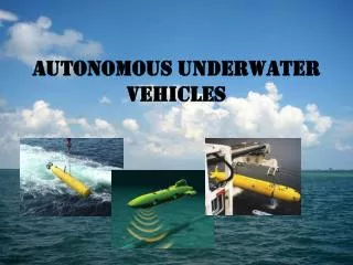
Autonomous Underwater Vehicles (AUVs). A general primer. What can AUVs do?. Hydrographic surveys Harbor security operations Debris field mapping Fishery operations Mine counter measure operations Environmental monitoring Search and salvage operations Scientific sampling and mapping.

E N D
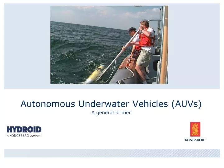
Autonomous Underwater Vehicles (AUVs) A general primer
What can AUVs do? • Hydrographic surveys • Harbor security operations • Debris field mapping • Fishery operations • Mine counter measure operations • Environmental monitoring • Search and salvage operations • Scientific sampling and mapping
Current Civil Uses • Fisheries • NOAA REMUS 100 scallop beds • Rutgers REMUS 100 fish tag tracker • Off-Shore Oil • C&C Hugin 4500 Oil Exploration • Fugro/Chance REMUS 100 shallow survey • Science/Salvage (various gov, academic, and private companies) • REMUS 100 • REMUS 600, 1500 • REMUS 6000
Current Military Uses • MCM – REMUS 100s & 600s, Hugin • Spec Ops – REMUS 100s • Oceanographic/Hydrographic (NAVO) • REMUS 100 • REMUS 600, 3000 • REMUS 6000 • Hugin • R&D - ONR REMUS 100s and 600s • Classified Programs
REMUS 100COMPACT SIZE & WEIGHT • Compact size and weight: Weighing in at only 80 lbs., REMUS allows for economical overnight shipping and ease of deployment and recovery.
REMUS 600, 1500, 3000Greater Depth and Payload Capability • 600 m depth • 1500 m using thicker body • 3000 using Titanium hull • 600 lbs and 10-12 ft. • Up to 70 hours depending on speed and payload.
HuginOff-Shore Industry Workhorse 1000, 3000, 4500m Optimized for “Off-Shore” Sub-Bottom Profiler HiPAP Industry common standards Proven Reliability
REMUS 6000Full Ocean Depth 6000 m or full ocean depth 12 ft long x 28 inches max D 1900 lbs 0.5 to 5 kts Up to 22 Hour missions 2 Hour battery change or 8 Hour full recharge
R&D vs ProductionREPEATABILITY Repeatability = Cost Savings Rapid Delivery Regular Schedule
Typical Sub-Systems • Mission Planning Software • Communications • Typical Sensors • Sonar – Side Scan, Multi-Beam, Synthetic Aperture • Sub-Bottom Profiler • ADCP, CTD • Other Payloads • Camera (Video, Still, Film) • Water Quality
Mission Planning Example of REMUS Vehicle Interface Program (VIP) Compatible with COIN, MEDAL, other planning tools. Compatible with multiple digital charts
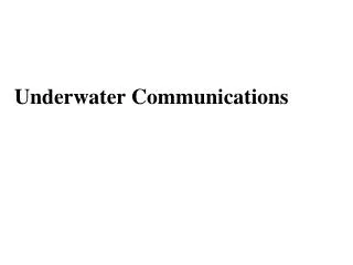
Communications ACOMM/LBL Transducer (Top) GPS/Iridium/WiFi Antenna LED Strobe
Communications Acoustic
Communications Wifi Free Wave Iridium Acoustic
Communications Wifi Free Wave Iridium
REMUS DATA Collected data includes: • Side scan sonar • Acoustic Doppler Current Profiler (ADCP) • Conductivity and temperature • Optical backscatter • Navigation data including: Long Base Line (LBL), Ultra Short Base Line (USBL) and dead reckoning accuracies. • Bathymetry • Heading, roll and pitch • Sound speed • Mission progress • Systems status • New sensors are being continually added…
Sensor DataSide Scan Sonar Tire Sand Reef
Sensor DataMulti-Beam Year 2002. HUGIN bathymetry from the Ormen Lange field. Mapped with HUGIN II and EM 3000 multibeam echosounder. NUI AS.
Sensor DataMulti-Beam and Sub-Bottom Profiler Overlay of MBE and SBP data.
Sensor DataInterferometer Can yield 3D images as if merging SSS and Multi-Beam Illustrative GEOSwath images
1 KW HR LITHIUM ION BATTERY UP/DOWN LOOKING ACOUSTIC DOPPLER CURRENT PROFILER NAVIGATION TRASPONDERS CHEMICAL LIGHT BRACKET SIDE SCAN SONAR CONDUCTIVITY & TEMPERATURE LIGHT SCATTERING SENSOR MAGNETIC ON/OFF POWER/DATA INTERFACE MODULE ACOUSTIC TRANSDUCER & CABLE REMUS RANGER RUGGEDIZED LAPTOP & GUI Questions