Download

1 / 47
500 likes | 720 Views
Satellite Image Products. NOAA AVHRR ( Advanced Very High Resolution Radiometer – AVHRR). Available since October 1978. Temporal res: 12 hours! Spatial res: 1.1 km. AVHRR. North Carolina coast. Landsat Multispectral Scanner (MSS). MSS (Multispectral Scanner)

E N D
NOAA AVHRR(Advanced Very High Resolution Radiometer – AVHRR) Available since October 1978. • Temporal res: 12 hours! Spatial res: 1.1 km
AVHRR North Carolina coast
Landsat Multispectral Scanner (MSS) • MSS (Multispectral Scanner) • Available from July 1972 through November 1997 • scene size: 185 km x 185 km • spatial resolution: 79 meters • radiometric resolution: 0 - 127 (7 bit) • temporal resolution: 16 - 18 days • spectral resolution (bands): • 2 visible (green, red) • 2 near-infrared • Applications: • agriculture, cartography, environmental monitoring, forestry, land use planning and oceanography
Landsat MSS Sydney, Australia on 11 December 1972.
Landsat Thematic Mapper (TM) • Landsat TM (Thematic Mapper) • Available July 1982 – May 31, 2003 • Problems since then • scene size: 185 km x 185 km • spatial resolution: 30 meters • radiometric resolution: 0 - 255 (8 bit) • temporal resolution: 16 days • spectral bands: • 3 visible (blue, green, red) • 2 near- & mid-infrared • 1 thermal infrared - Earth temperature mapping: 120 meter resolution (60m res for Landsat 7, since 1999)
Landsat 7 Enhanced Thematic Mapper (ETM+) • Landsat 7 - ETM (Enhanced Thematic Mapper) • launched in April 1999 • Broke May 31, 2003 • scene size: 183 x 170km • panchromatic band • 15 meter spatial resolution • multispectral bands • 30 meter spatial resolution • 1 thermal infrared (has different spatial res: 60 meters)
Landsat 7 Enhanced Thematic Mapper (ETM+) Hurricane Floyd NC flooding
Landsat TM New Orleans August 30, 2005 New Orleans April 24, 2005
Landsat 7 Gap-filled products Some images are available with gaps filled in by images from other, nearby dates
SPOT Multispectral (XS) • SPOT - French commercial satellite data company • SPOT XS (Multispectral) • scene size: 60 km x 60 km • spatial resolution: 20 meters • radiometric resolution: 0 - 255 (8 bit) • temporal resolution: nominally 26 days • spectral bands: • 2 visible (green, red) • 1 near-infrared • 1 SWIR (short wave infra-red) since 1998 (SPOT 4)
Spot PAN • SPOT PAN (Panchromatic) • scene size: 60 km • spatial resolution: 10 meters • radiometric resolution: 0 - 255 (8 bit) • temporal resolution: nominally 26 days
SPOT 5 • Since May 2002 • Higher resolutions: • 5m panchromatic • 10m visible/NIR bands, • 20m SWIR
SPOT Operational Capability http--spot5.cnes.fr-gb-images-112gb_1.jpg
Pointable SPOT Sensors Multiple view angles possible. Can be used to create Digital Elevation Models (DEMs) and fly through movies.
SPOT 5 image from stereopair • Naples and Mount Vesuvius from data collected shortly after SPOT-5 became operational:
Ikonos Owner: Space Imaging (a commercial group) Launched: September 1999 Temporal resolution: 11 days (1-3 days considering oblique views) Radiometric resolution: 11-bit (8x better than TM or SPOT) Spectral bands spatial resolution 0.45-0.52 (blue) 4m 0.51-0.60 (green) 4m 0.63-0.70 (red) 4m 0.76-0.85 (NIR) 4m 0.45-0.90 (Panchromatic) 1m Swath width: 11km Sensor systems: pushbroom system, pointable both along track and across track. Orbit: 682km sun-synchronous having an equatorial crossing time of 10:30am
Space Imaging IKONOS – multispectral, 4 meter spatial resolution • San Francisco, CA
Ikonos Image - Athens Olympic Sports Complex July 24, 2004
Quickbird Owner: Digital Globe (another commercial group, the competition!) Launched: October 18, 2001 Temporal resolution: 1-5 days (considering oblique views) Radiometric resolution: 11-bit (8x better than TM or SPOT) Spectral bands spatial resolution 0.45-0.52 (blue) 2.5m 0.52-0.60 (green) 2.5m 0.63-0.69 (red) 2.5m 0.76-0.90 (NIR) 2.5m 0.45-0.90 (Panchromatic) 60cm Swath width: 16.5km Sensor systems: pushbroom system, pointable both along track and across track. Orbit: 450km sun-synchronous having an equatorial crossing time of 10:30am
Quickbird Image - Athens Olympic Sports Complex August 23, 2004
TERRA • New NASA Earth Observing System (EOS) satellite • Terra began collecting data on Feb 24, 2000 • Contains multiple sensors • ASTER (Advanced Spaceborne Thermal Emission and Reflection Radiometer) • - only high spatial resolution sensor on TERRA • scene size: 60km • 3 bands in visible & near-infrared • 15-meter spatial res., 8-bit spectral res. • 6 bands in reflected/mid-infrared • 30-meter spatial res., 8-bit spectral res. • Good for Landsat follow-up work • 5 bands in thermal infrared • 90-meter spatial res., 12-bit spectral res. • applications include: vegetation mapping, landcover change, glaciology, evapotranspiration studies, hydrology, volocanolgy, geology
ASTER After unusually severe spring tides devastated this region in 1953, the Dutch built an elaborate system of dikes, canals, dams bridges and locks to hold back the North Sea. This simulated natural color image was acquired on September 24, 2002, and covers an area of about 50.6 x 52.4 km.
ASTER Bucket-line dredging for gold took place almost continuously from 1903 to 1968. The Yuba Goldfields are located along the lower Yuba River about 10 miles east of Marysville, California.Taken August 29, 2001, covers an area of 21.2 x 16.5 km
MODIS • AVHRR has been superceded by MODIS (Moderate Resolution Imaging Spectrometer) which is a project being run by NASA, in partnership with the USGS (US Geological Survey) • The MODIS sensors are the ‘centerpiece’ sensors on two new satellites that have been called Earth Observing Systems (EOS-AM and EOS-PM), codenamed Terra and Aqua • Terra was designed to focus on land-based applications and has an equatorial overpass time of about 10:30 AM, while Aqua was designed for more sea-oriented applications and has an equatorial overpass time of about 2:30 PM, and the MODIS sensors on them are known as MODIS-AM and MODIS-PM
MODIS Characteristics Temporal resolution: 1-2 days Spatial Resolution: 250 m (bands 1-2) 500 m (bands 3-7) 1000 m (bands 8-36) Radiometric resolution: 12 bits Spectral resolution: shown on next slide Design Life: 6 years Orbit: 705 km Sensor Systems: Across Track Scanning (‘Wiskbroom’)
MODIS Bands
MODIS Applications - Fire Damage Pre-forest fire Post-forest fire Burnt area identified from space
MODIS Applications - SST SST = Sea Surface Temperature
MODIS Applications - Algae Spectral Properties of Water with Algae Algae absorbs a significant amount of CO2, and its presence / absence / abundance is important to understanding the ocean. It is useful to track the spatial and temporal dynamics of algae blooms.
MODIS Applications - Algae Phytoplankton bloom in the Black Sea. MODIS band 1 (red), 4 (green) and 3 (blue)
MODIS Applications - Clouds Cloud types from MODIS: pink - cold high level snow and ice clouds; neon green - low level water clouds. These two cloud types reflect and emit energy differently.
MODIS Applications - Snow Spectral Properties of Clouds and Snow In the visible spectrum clouds and snow look very similar. Thus, it is difficult to separate them with human eyes. But they are very different in the mid-infrared
MODIS Applications - Snow A massive iceberg, one of the largest ever observed, broke off the Ross Ice Shelf near Roosevelt Island in Antarctica in mid-March 2000. This iceberg is about 40 miles wide and 300 miles long. The breaking off of such a big iceberg may be related to global climate change.
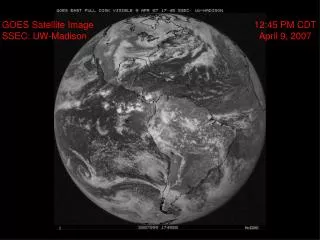
The GOES Program • The GOES (Geostationary Orbiting Environmental Satellite) program is a joint venture between the National Aeronautical and Space Administration (NASA) and the National Oceanic and Atmospheric Administration (NOAA) • NASA’s primary responsibility was to engineer the launch of the satellites and place them in orbit • NOAA is concerned with the science associated with the collected data; the GOES satellites are primarily applied to atmospheric research (collecting meteorological and climatological data, describing the composition of the atmosphere, predicting severe weather, tracking sea surface temperatures, etc.)
GOES satellite system • Instead of revolving around the Earth every 90-100 minutes in a sun-synchronous orbit like the other satellites we have discussed, these satellites were placed into an orbit that maintains a fixed relationship with the Earth • GOES-10 is currently designated GOES-EAST and is imaging the Americas and the Atlantic Ocean • GOES-11 is in orbit and dormant, waiting to be used to replace another satellite when it fails (in storage) • GOES-12 is currently designated GOES-WEST and is imaging the Pacific Ocean
GOES-East and GOES-West http://noaasis.noaa.gov/NOAASIS/ml/genlsatl.html
http://noaasis.noaa.gov/NOAASIS/ml/imager.html The GOES Imager • The current GOES satellites carry multiple sensors, but the one we are chiefly interested in is simply called the Imager
GOES resolutions • Temporal: 15 minutes! • Spatial: 8 kilometers • Radiometric: 13-bit (much more than most others which are 8-bit) • Spectral: next slide
GOES Spectral resolution GOES Bands
GOES-East North America Images http://www.ssec.wisc.edu/data/east/latest_eastvis.jpg
GOES-East North America Images http://www.ssec.wisc.edu/data/east/latest_eastir.jpg
GOES-East North America Images http://www.ssec.wisc.edu/data/east/latest_eastwv.jpg
GOES Derived Products - Fire http://cimss.ssec.wisc.edu/goes/burn/wfabba/wfabba_nag12.html
GOES Derived Products - Clouds http://cimss.ssec.wisc.edu/goes/realtime/ctpimgg12.05067.2100.gif
GOES Derived Products - SST http://www.ssec.wisc.edu/data/sst/latest_sst.gif