Download
1 / 24
240 likes | 393 Views
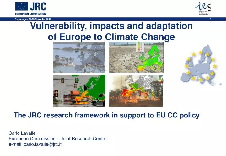
Vulnerability, impacts and adaptation of Europe to Climate Change. The JRC research framework in support to EU CC policy Carlo Lavalle European Commission – Joint Research Centre e-mail: carlo.lavalle@jrc.it. EU Climate Change Policy. Reducing Climate Change Risk. MITIGATION.

E N D
Vulnerability, impacts and adaptation of Europe to Climate Change The JRC research framework in support to EU CC policy Carlo Lavalle European Commission – Joint Research Centre e-mail: carlo.lavalle@jrc.it
EU Climate Change Policy Reducing Climate Change Risk MITIGATION ADAPTATION by + Reducing Exposure & Vulnerability Reducing & Avoiding GHG emissions at the lowest cost & greatest benefit. Within the frame work of its mission, the JRC aims to develop reference knowledge, based on multi-disciplinary expertise, to ease the development of an EU climate change policy.
Adaptation: What can be done? • Understanding and prediction of Climate Change. • Special attention to extrem events • Quantification of impacts at the continental, regional, and local levels (risk analysis) • Historical trend analyses • Data modelling • Coupling with Regional Climate Models • Analysis of adaptation measures • strategies to prevent and reduce impacts and damages • Management and preparedness (include modelling and scenario preparation). • Focus on early warning systems • Integration of all aspects related to adaptation to climate change into strategies for sustainable development.
Exposure Hazard Population Infrastructure Settlements Ecological assets …. Hazard degree Flood Drought Forest Fires Heatwaves Risk assessment for Natural Hazards The Approach Risk = hazard x exposure x vulnerability Vulnerability GDP/ capita Planning regulations Protection measures Warning systems Insurance mechanism Access to facilities … Method of analysis Risk
EU Flood Risk Maps Exposure Vulnerability flood hazard Flood depth maps for different return-periods High Flood Risk Areas Annual Average Damage Flood Risk Index
About 65,000 wildfires / year in EU About 500,000 hectares burned / year in EU EU Forest Fire Risk Maps Data from Member States (the EU Forest Fire Data Base, built upon the Common Core Database) + Model (European Forest Fire Information System) + Observed fires (remote sensing)
Heatwave Risk Map Heatwave Extent + Population Exposed + Population Number Vulnerable Population Group Vulnerable Population Exposure No. of people over 65 years exposed to HUMIDEX exceeding 35 during June, July and August 2003
wetter normal drier very wet very dry European Drought Hazard Maps Soil Water Stress from ECMWF ERA 40 meteo data 07/1957-06/2002 daily top soil moisture daily top soil moisture anomaly
Impacts on Agriculture Growing season lenght Shift of flowering season
flood risk Assessing future risks Flood & drought risk and climate change exposure vulnerability high-resolution climate information x flood hazard European data on soils, land cover, river basins, ... LISFLOOD = Member States data on river dimensions, discharges, ...
Climate change effect on river discharge:annual average and 100-year floods seasonal changes in mean discharge Simulations with LISFLOOD driven by HIRHAM – HadAM3H/ HadCM3 (data from Prudence, DMI)
Climate change effect on low flows:change of mean annual 7-day minimum discharge Simulations with LISFLOOD driven by HIRHAM – HadAM3H/ HadCM3 (data from Prudence, DMI)
Forest Fire Danger Fire Severity Index (Climate data from Prudence – DMI)
Climate Change Hazard: Heat Wave Scenario Period 2071-2100 Control Period 1961-1990 Heat wave event defined by HWDI of 7 continuous days during summer period Based on data from Danish Climate Centre (DMI) within the framework of the EU-project PRUDENCE
Simulated flooded areas Change in annual precipitation Monetary impacts of Climate Change Scenarios Flooded areas statistics Cost estimation made per land use classes, using approx. deoth-damage curves Next steps: include land use simulations and adaptation measures Tentative estimate upper Danube: Current Climate: 100 Billion Euro damage A2 Scenario ~40% increase in total damage Pilot area in the Upper Danube – Preliminary draft results
Forest vulnerability and suitability Current and future habitat suitability distribution of European Common Beech (Fagus sylvatica, Fagaceae) Regression tree Analysis – Vegetation suitability model IPCC SRES A1B Scenario, 2000 - 2100 vegetation shift projection under 710ppm CO2 , +2.8ºC Preliminary draft results
The aim of adaptation: Reduce the risk + = Hazard Vulnerability Risk p =1 (100yr) Risk Vulnerability + Low vulnerability Low risk = Hazard Adaptation p =1 (100yr) Vulnerability Adaptation
EFFIS EFAS EDO MOLAND LISFLOOD EFICS Integrated land management tools EFAS=European Flood Alert System EDO=European Drought Observatory EFICS=European Forest Inform. and Comm. System EFFIS=European Forest Fire Information System MOLAND=Monitoring Land Use Dynamics LISFLOOD=Grid-based catchment model Component of EU Forest Focus Territorial Integration
EU Flood GIS Realtime H-Q data Historical Data Static Data Meteo -Data Europ. Data Layers Expert Knowledge of Member States European Flood Alert System EFAS EFAS Reports min area = 50 km²
EDO European Drought Observatory Soil moisture 7 day trend wetter drier
Floods and scenario modeling Elbe catchment Land use Reference Land Use Polders Reservoirs 10% reduction
European Forest Fire Information System EFFIS Meteorological Risk Vegetation Stress Risk Structural Risk Fire Potential Index
Damage assessment Floods and industrial installations Forest Fires and NATURA 2000 sites
Conclusions – Next steps at JRC Key Scientific Challenges: • include other SRES scenarios and RCMs • better quantification of current and future vulnerability • development of high-resolution land use scenarios • model validation with high-quality observations & data sets • formal treatment of uncertainty in the processing chain Opportunities: • Direct inputs to EU policies (e.g. White paper on adaptation) • Participation in experts’ networks • Collaboration with MS organisations