Download

1 / 26
260 likes | 267 Views
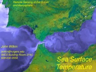
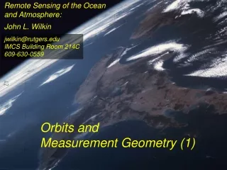
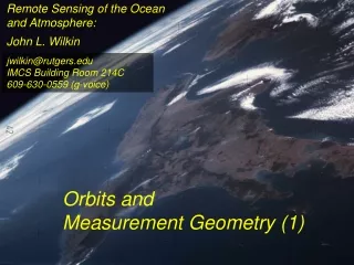
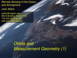
Remote Sensing of the Ocean and Atmosphere:. John Wilkin. jwilkin@rutgers.edu IMCS Building Room 214C 732-932-6555 ext 251. Orbits and Measurement Geometry. Johannes Kepler (1571 – 1630) German mathematician, astronomer and astrologer.

E N D
Remote Sensing of the Oceanand Atmosphere: John Wilkin jwilkin@rutgers.eduIMCS Building Room 214C732-932-6555 ext 251 Orbits and Measurement Geometry
Johannes Kepler (1571 – 1630) German mathematician, astronomer and astrologer • Planets move in elliptical orbits with the sun as one focus • the radius vector from the sun to the planet sweeps out equals areas in equal times • T2 : R3 ratio is constant for all planets, where T is orbital period and R is semi-major axis of the orbit
Stewart, R. H., 1985, Methods of Satellite Oceanography, University of California Press, 360 pp.
x-axis Stewart, R. H., 1985, Methods of Satellite Oceanography, University of California Press, 360 pp.
http://spaceflight.nasa.gov/realdata/elements • See graphics of orbital elements and data for ISS
Jason-1 launch from Vandenburg Air Force Base, CaliforniaOrbit:http://www.aviso.oceanobs.com/en/missions/current-missions/jason-1/orbit/index.html Launch: http://www.youtube.com/watch?v=Z4WHOSF2Ktg Other launches: Delta-II (Themis):http://www.youtube.com/watch?v=p_pAhPecto0 Ariane: http://www.youtube.com/watch?v=OfONuo3h3t0 http://www.youtube.com/watch?v=kYUrqdUyEpI Jason-2 OSTMhttp://www.youtube.com/watch?v=cf0loVEs_lo Topex/Poseidon launched with Ariane rocket http://sealevel.jpl.nasa.gov/gallery/tiffs/videos/launch.mov Pegasus vehicle aircraft launch http://www.youtube.com/watch?v=QRHiTvRHHd8
OSTM / Jason-2 Boost Profile Space craft separation:
Hohmann Transfer Maneuver to different inclination http://en.wikipedia.org/wiki/Hohmann_transfer
http://www.nytimes.com/2007/02/06/science/space/06orbi.html?emc=eta1http://www.nytimes.com/2007/02/06/science/space/06orbi.html?emc=eta1 On Jan 11, 2007, China tested an anti-satellite rocket. The initial collision added 800 to 1000 pieces of space junk to the current total of detectable objects. How many detectable objects (< 4 inches) are in orbit? Collisions between existing debris generate additional pieces of debris. There is concern that eventually a chain reaction will ensue (the Kessler syndrome) littering the low earth orbit (LEO) with debris making it almost impenetrable to new satellite launches for fear of collision. http://www.nytimes.com/2007/02/06/science/20070206_ORBIT_GRAPHIC.html Kessler, D. J., and Burton G. Cour-Palais. "Collision frequency of artificial satellites – The creation of a debris belt." Journal of Geophysical Research Vol. 83 (June 1978): 2637-2646.
http://spaceflight.nasa.gov/realdata/elements • See graphics of orbital elements and data for ISS
Sidereal day = time it takes for Earth to rotate through 360o This is slightly shorter than a solar day (24 hours) There are 365.25 solar days in a year but 366.25 sidereal days Sidereal day = 365.25/366.25*24 = 29.93 hours solar sidereal http://en.wikipedia.org/wiki/Sidereal_time
Terra satellite, MODIS instrument, coverage of all instrument swaths during a single day ( 01/28/2006 )
ENVISAT 35-day repeat Jason altimeter satellite Equatorial separation of Jason groundtracks is 315 km
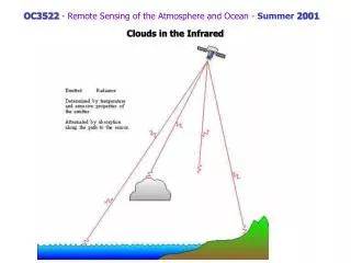
Scan geometry • zenith angle w.r.t. satellite nadir • look angle and solar zenith angle w.r.t local vertical • Fixed solid angle Field of View (FOV) such as for an optical lens, gives elliptical footprint off-nadir and varying spatial resolution in the scan
View satellite orbits and ground tracks at: http://science.nasa.gov/realtime/jtrack/Spacecraft.html
Internet resources on orbits and satellites • http://science.nasa.gov/realtime/jtrack/Spacecraft.htmlShows ground tracks and 3-D orbits for all satellites • Notice the clusters of satellites in the major categories or orbits • Geostationary • Polar orbiting (NOAA, Topex, ERS, Envisat) • Low Earth orbit (Iridium, HST, ISS) • GPS • Unusual orbits (especially ground track) • Chandra • IMAGE • CRRES (in a geosynchronous transfer orbit) • http://heavens-above.comShows predicted orbits and visibility magnitudes and star charts of pass trajectories for all satellites • See Homework 1 http://tinyurl.com/11-670-451-homework-1 • http://spaceflight.nasa.gov/realdata/elements • See graphics of orbital elements and data for ISS • Real-time satellite tracking at http://www.n2yo.com