Download
1 / 22
220 likes | 365 Views
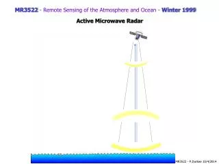
MR3522 - Remote Sensing of the Atmosphere and Ocean - Winter 1999. Active Microwave Radar. *. H. *. L. *. variations in mass concentration in the earth will distort the surface. an atmosphere will distort the surface. also tides will distort the surface. Operation q = 0

E N D
MR3522 - Remote Sensing of the Atmosphere and Ocean - Winter 1999 Active Microwave Radar
* H * L * • variations in mass concentration in the earth will distort the surface. • an atmosphere will distort the surface • also tides will distort the surface • Operation • q = 0 • transmit a very short pulse (Dt = 3 ns or 1 m), therefore the pulse has some thickness and width (determined by gain, GT) • Signal Processing • Time delay gives satellite-surface distance • Consider the earth covered with water, no atmosphere, and no currents • then water surface is an equipotential surface (equal gravitational force)
Definitions geop: equipotential surfacegeoid: geop at mean sea level (approximately an ellipsoid)geoid undulation: difference between reference ellipsoid and geoid (~60m)sea surface topography: difference between sea surface and geoid contributions to sea surface topography: tides - 1 meter currents - 1m/100km atmospheric pressure - few cm
The Geoid provides information about the ocean bottom topography
The Sea Surface Topography provides information about ocean currents
Errors in measurement of ocean height orbit: 0.3-0.5 m (dominant), laser tracking can reduce this for short timescoordinate systems: < 10-20 cm, includes: tracking network, geoid description inertial reference frame, time and position of earthionosphere: ~0.5 cmatmospheric gases: Airmass ~ 2.3 m (correctable to ~0.7 cm), water vapor - 6-30 cm (correctable to ~1 cm)ocean waves: troughs reflect better than crests (1-2 cm bias)rain: failure if rain rate> 5mm/hr (avoidable)calibration/instrument errors: ~7 cm
Scattering cross Section, so • There are two primary mechanisms which contribute to so • (1) Specular Reflection • Near vertical incidence • reflection of mirror-like facets s0 increasedwind speed 10 20 30 0 q Important for q < 20° (almost no wave slopes >25°)
Greater SWH Greater Dt from first photon received to peak Greater Wind Speed Less total power received The Received Power W(t) provides information about: Significant Wave Height (SWH)Wind Speed
Standard Errorin Altimeter Wind Speed estimates is about 2 m/s
TOPEX/Poseidon During August 1992, TOPEX/Poseidon was launched into Earth's orbit by an Ariane 42P rocket from the European Space Agency's Space Center located in Kourou, French Guiana -- the first launch of a NASA payload from this site. From its orbit 1,336 kilometers (830 miles) above the Earth's surface, TOPEX/Poseidon measures sea level along the same path every 10 days using the dual frequency altimeter developed by NASA and the CNES single frequency solid-state altimeter. This information is used to relate changes in ocean currents with atmospheric and climate patterns. Measurements from NASA's Microwave Radiometer provide estimates of the total water-vapor content in the atmosphere, which is used to correct errors in the altimeter measurements. These combined measurements allow scientists to chart the height of the seas across ocean basins with an accuracy of less than 13 centimeters (5 inches)! The dual-frequency NASA radar altimeter is the primary instrument aboard the spacecraft. It works by sending radio pulses at 13.6 GHz and 5.3 GHz toward the earth and measuring the characteristics of the echo. By combining this measurement with data from the microwave radiometer and with other information from the spacecraft and the ground, scientists can calculate the height of the sea surface to within 4.3 centimeters.
ERS-2 Altimeter Mass: <= 96 kg Antenna diameter: 1.2 m DC power: <=134.5 W Data rate: <= 15 kbit/sec RF frequency: 13.8 GHz (Ku band) Bandwidth: ocean mode : 330 MHz ice mode : 82.5 MHz Pulse repetition frequency: 1020 Hz RF transmit power: 50 W Pulse length: 20 micro-s chirp Altitude measurement: 10 cm (1s, SWH = 16 m) Significant wave height: 0.5 m or 10% (1s) whichever is smaller Backscatter coefficient: 0.7 dB (1s) Echo waveform samples: 64 x 16 bits at 20 Hz Beam width: 1.3deg. Foot Print: 16 to 20 km (depending on sea state)
NAVY GEOSAT FOLLOW-ON (GFO) • ALTIMETRY MISSION • Satellite Launched 10 February 1998 • The 300-kg spacecraft is approximately 3-m long and supports the following payload • Radar Altimeter - single frequency (13.5 GHz) with 3.5-cm height precision. • Water Vapor Radiometer - dual frequency (22 and 37 GHz) nadir-looking with a path correction accuracy of 1.9 cm rms. • GPS Receivers - redundant receivers allow precision orbit determination with an rms accuracy in the radial component of 10 cm on wavelengths less than 40,000 km. • Doppler Beacon - GEOSAT performance-stable oscillators and doppler beacons will allow operational orbits to be determined with 1.8-cm rms radial orbit error for mesoscale oceanography (after tilt and bias removal along a 3000-km arc-filter length.
JASON Jason is a oceanography mission to monitor global ocean circulation, discover the tie between the oceans and atmosphere, improve global climate predictions, and monitor events such as El Niño conditions and ocean eddies. The Jason-1 satellite carries a radar altimeter and it is a follow-on mission to the highly successful TOPEX/Poseidon mission. It is joint mission between France and USA. The satellite will be launched in May 2000.
Interesting Altimeter sites: Cal/Val data Altimeter Missions