Download
1 / 21
210 likes | 387 Views
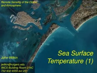
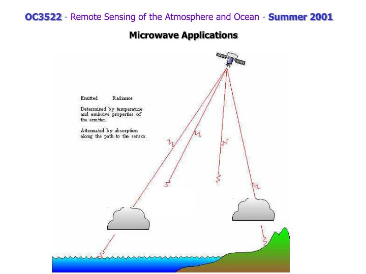
OC3522 - Remote Sensing of the Atmosphere and Ocean - Summer 2001. Microwave Applications. Remember that … (surface temp, air Temp, surface emittance, transmittance).

E N D
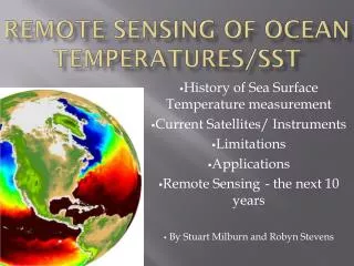
OC3522 - Remote Sensing of the Atmosphere and Ocean - Summer 2001 Microwave Applications
Remember that … (surface temp, air Temp, surface emittance, transmittance) Applications Include: Water Vapor, Precipitation, Surface Wind Speed, Liquid Water, Sea Ice, Soil Moisture, (future salinity)
19v 19h 22v 37v 37h 85v 85h An example of “raw” SSM/I images - one for each channel TB http://www.nrlmry.navy.mil/~white/pages/frame2.htm Other examples of products
Algorithms http://orbit-net.nesdis.noaa.gov/arad2/MSPPS/html/day2/algorithm_day2.html#ATPWCLW http://amsu.cira.colostate.edu/
Special Sensor Microwave/Imager (SSM/I DMSP satellite) n (GHz)l (cm)rc (=l/p) (cm)85 0.35 0.11 (1.1mm) 37 0.81 0.26 22 1.36 0.43 19 1.58 0.50 http://podaac.jpl.nasa.gov:2031/sensor_docs/ssmi.html#2.
Tropical Rainfall Measuring Mission (TRMM satellite; TRM instrument) n (GHz)l (cm)rc (=l/p) (cm)85 0.35 0.11 (1.1mm) 37 0.81 0.26 22 1.36 0.43 19 1.58 0.50 10.3 0.50 (hpol/vpol)
Combined Effects Wind Speed LiquidWater WaterVapor Salinity 10 20 30 40 (arbitrary units) Frequency (GHz) Ts SSM/I Channels
Wind Speed At MW frequencies, emittance depends on polarization (vertical > horizontal) TB TB *use information that e is a function of windspeed
Wind Speed LiquidWater WaterVapor Salinity 10 20 30 40 (arbitrary units) Frequency (GHz) Ts WindSpeed = A0 + A1 TB19v - A2 TB22v- A3 TB37v + A4 TB37h
Wind Speed http://manati.wwb.noaa.gov/old/ssmiwinds.html SSM/I WindSpeed = 147.90 + 1.0969 TB19v - 0.4555 TB22v - 1.7600 TB37v + 0.7860 TB37h Goodberlet, M. A., Swift, C. T. and Wilkerson, J. C., "Remote Sensing of Ocean Surface Winds With the Special Sensor Microwave/Imager", J. Geophys. Res.,94, 14574-14555, 1989
The NASA Team Algorithm (Cavalieri et al, 1984) PR = [TB(19V)-TB (19H)]/[TB (19V)+TB (19H)] (1) polarization ratio GR = [TB (37V)-TB (19V)]/[TB (37V)+TB (19V)] (2) spectral gradiant ratio where TB is the observed brightness temperature at the indicated frequency and polarization. From these two parameters the first-year ice concentration (CF) and the multiyear ice concentration (CM) are calculated from the following equations: First-year ice concentration = (a0 + a1PR + a2GR + a3PR * GR)/D (3) Multi-year ice concentration = (b0 + b1PR + b2GR + b3PR * GR)/D (4) where D = c0 + c1PR + c2GR + c3PR * GR (5) The total ice concentration (CT) is the sum of the first-year and multiyear concentrations
Daily, Monthly, Yearly SSM/I Data Products at: http://www.ssmi.com/ssmiDaily.html
Ocean Salinity Scanning Low Frequency Microwave Radiometer (SLFMR) airborne salinity mapper. (J. Miller, NRL and J. Zaitzeff, NOAA/NESDIS).