Download
1 / 17
170 likes | 307 Views
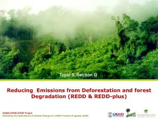
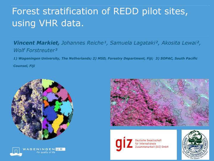
Forest stratification of REDD pilot sites, using VHR data. Vincent Markiet, Johannes Reiche¹, Samuela Lagataki², Akosita Lewai², Wolf Forstreuter³ 1) Wageningen University, The Netherlands; 2) MSD, Forestry Department, Fiji; 3) SOPAC, South Pacific Counsel, Fiji. Content of presentation.

E N D
Forest stratification of REDD pilot sites, using VHR data. • Vincent Markiet, Johannes Reiche¹, Samuela Lagataki², Akosita Lewai², Wolf Forstreuter³1) Wageningen University, The Netherlands; 2) MSD, Forestry Department, Fiji; 3) SOPAC, South Pacific Counsel, Fiji
Content of presentation • Introduction • Goals • Study area • Data • Methodology • Preliminary results • Discussion
Introduction • M.Sc. RS/GIS, 2 year master WUR • M.Sc. internship exchange funded by GIZ. • 4 month internship • Internship at forestry, supervised by Johannes Reiche (WUR)
Motivation • Forest classification is important: • Forest management • Monitoring of biodiversity • Objective: • Investigate possibilities for classifying forest strata using object based classification.
Goals • Object-based forest strata classification scheme, using VHR data • 3 forest classes (open forest, closed forest, scattered/degraded forest) more if time allows. • Undisturbed, disturbed forest • Integrate 1969 forest inventory classes
Study area • REDD+ test site • Dogotuki, Vanua Levu • District Makuata • Mixture of plantation & native forest (lowland forest)
Data • VHR World View data • Multispectral 0.5m spatial resolution • 5 VHR images (acquired July & October 2013) • 4 MSS bands (Red, Green, Blue, Near-infrared) • Digital Elevation Model (DEM) • Resolution 25m • Reference data • NFI plots (forest types: Open-, Closed-, MU forest) • 1969 NFI topo sheets
Object based classification (1) • Alternative classification technique • Combines spectral & spatial information • Object based classification enables detailed forest segmentation. • Improved land cover & land use mapping • Semi- or/and automized classification • Erdas Imagine objective tool
Object based classification (2) • Use reference data to select training samples. • Object based segmentation • Different input parameters (weighted) • Size • Shape • Reflectance values • Texture Source: Erikson, (2014)
Methodology (2) • Validation & accuracy assessment • Confusion Matrix • Quantitative method of accuracy assessment • Reference data vs classified object segments • Classified area compared to test area OF = Open forest, CF = Closed forest, SF = scattered forest
Methodology (3) • Forest Inventory 1969 used as reference data
Mixture of vegetation types -forest -grassland/shrubs • Segmentation still not optimal. • Fuzziness • More filtering necessary • Grasslands conflict with forest segmentation
Preliminary results • Forest / Non-forest • Segmentation should focus towards forest strata classes. False colour 432 RGB image Forest segmentation
Discussion points • Overall goal: Investigate possibilities for classifying forest strata using object based classification. • Challenges • Spectral homogeneity among forest classes • Forest border determination is challenging • Lot of trial and error necessary with testing best segmentation parameters. Many possible combinations. • Good reference data is essential for assessment. • Ground spectral information
Thank you for your attention Questions? Email:vincent.markiet@wur.nl