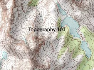
Topography
Using this approach we have integrated all of the tidal and leveling records from coastal Oregon to determine the 3d uplift pattern along the coast. Benchmark uplift rates projected contour-perpendicular. Topography. Updip Deformation Sources. Interseismic deformation due to plate convergence.


Topography
E N D
Presentation Transcript
Using this approach we have integrated all of the tidal and leveling records from coastal Oregon to determine the 3d uplift pattern along the coast. Benchmark uplift rates projected contour-perpendicular Topography
Updip Deformation Sources • Interseismic deformation due to plate convergence Trench Central OR Coast
Both NOAA’s calculated absolute sea level trend estimates and the more precise difference between the two sites suggest that North Spit subsides relative to Crescent City at about ~5.4 mm/yr. Given eustatic sea level rise of ~2.3 mm/yr for 1977 to 2010, Crescent City rises, absolutely, at ~3 mm/yr and North Spit sinks at about ~2.5 mm/yr.
Updip Deformation Sources • Interseismic deformation due to plate convergence Possibly? Crescent City North Spit Trench Trench Central OR Coast
Preliminary reanalysis of the HW101 line from the Strait of Juan de Fuca (BM) to Aberdeen (Ab) supports the hypothesis that at least part of the westernmost coast is subsiding and there are very large gradients in uplift. However, this is based on a short repeat time in the releveling and is a very long distance unsupported by tide gauges to assess cumulative error in the leveling. Tidal records from La Push (LP) and Point Grenville (PG) will confirm (or deny!) this hypothesis, and IF 2nd order leveling lines could be repeated between them and HW101 these tide gauges could stabilize the coast.
Earthquake geology indicates a megaquake occurs every ~700 years Nanayama, et al., Nature (2003) Sawai, et al., Nature (2003)
1857 Earthquake Surface Slip > 420 offset features identified (previous work identified ~150 offsets) Courtesy of O. Zielke
For the Carrizo Plain and Big Bend region we see repeated “characteristic” offsets of about five m. Courtesy of O. Zielke
Much of the deformation at the Wrightwood site is distributed across complicated small faults and folds that, in the few places we have deeply exposed them, root into low angle structures. To calculate the slip associated with these structures we have used a cross sectional area balancing approach often used to relate growth strata or erosional unconformities to detachments at depth.
Summary of Wrightwood Upper Section’s ages and offsets. Note the huge uncertainties in slip. It is difficult to measure slip per event because the deformation zone is broad and complex. But if the zone was simple we could document few earthquakes due to deformation overprinting. See Weldon et al., BSSA, 2002; GSA Today, 2004, for details
WW compared to new AMS dates at Pallett Creek 70% (10 of 14) correlate Last two quakes that don’t correlate have good evidence to be southern events. Paleoseismology, if done well is repeatable and gives us long interpretable records. Cluster at Wrightwood is made of multiple northern and multiple southern events, so can’t just be overlap.
Historic Period Extra North Bend events Went south 1857-like ? Went south The data Some interpretation
Summary of Wrightwood Upper Section’s ages and offsets. Note the huge uncertainties in slip. It is difficult to measure slip per event because the deformation zone is broad and complex. But if the zone was simple we could document few earthquakes due to deformation overprinting. See Weldon et al., BSSA, 2002; GSA Today, 2004, for details
Completeness – Constant sedimentation? Are there gaps in the record? Age Resolution – # of units per unit time? Number of dated units? Unit resolution – Thickness and distinctiveness of units. Sharpness and planarity of contact surfaces? Site characteristics – Narrow or broad zone of deformation? Degree of Exposure – Number of fault crossing trenches? Frequency of exposure of key layers? Ray’s Rule! Evidence quality – Some sort of paleoseismic index? Kate’s?
Good sections include closed depressions that grow peat between frequent deposits of sediments, like this example from the Wrightwood paleoseismic site. Pieces of charcoal or other organic material can be used as well but detrital charcoal may be older than the unit that contains it. Volume Time
With a sedimentation rate of ~1 m/100 yrs, and individual clastic units representing on average 5-10 years, we can distinguish events that are likely separated by decades. Here are two earthquakes separated by just 20-30 cms, and thus likely 20-30 years (as the C-14 shows in the next slide).
Completeness – Constant sedimentation? Are there gaps in the record? Age Resolution – # of units per unit time? Number of dated units? Unit resolution – Thickness and distinctiveness of units. Sharpness and planarity of contact surfaces? Site characteristics – Narrow or broad zone of deformation? Degree of Exposure – Number of fault crossing trenches? Frequency of exposure of key layers? Ray’s Rule! Evidence quality – Some sort of paleoseismic index? Kate’s?
Depositional Order Sum Event Quality vs. Stratigraphic Level Sum of Quality Sum of Observations
Event Quality vs. Stratigraphic Thickness Debris Flow Thickness Peat Thickness